
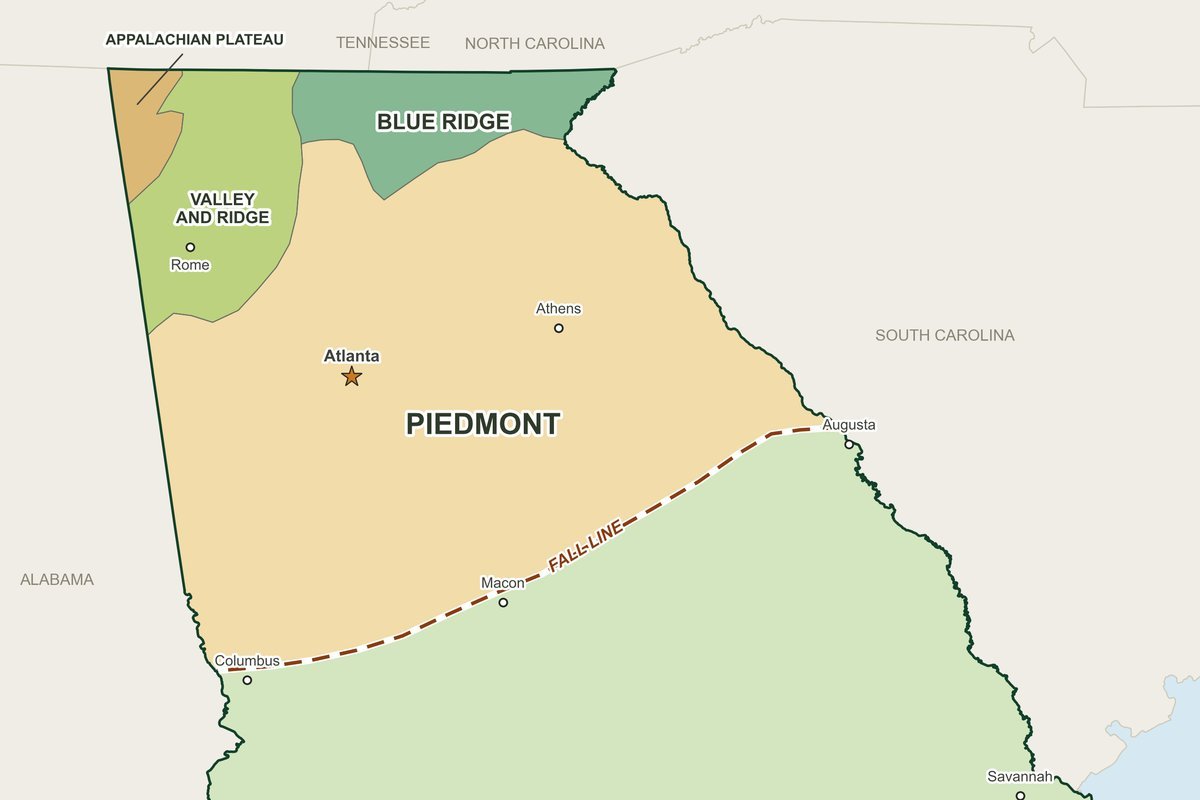
Map: N-Georgia.com, from USGS and U.S. Census Bureau public-domain data
Free printable maps of Georgia for teachers, parents and students: Georgia’s five geographic regions, its physical features and blank outline maps to color and label. Every map prints on standard 8.5 x 11 paper as a free PDF, and every boundary comes from public U.S. government data. The set follows the features named in Georgia’s social studies standards for second grade (SS2G1) and eighth grade Georgia Studies (SS8G1).
- CostFree for classroom and home use
- FormatLetter-size PDF (8.5 x 11) plus a full-size image
- MapsRegions, physical features, counties, rivers, cities and highways, with blank versions
- GradesBuilt for 2nd grade and 8th grade Georgia Studies, useful at any level
Georgia’s Five Geographic Regions
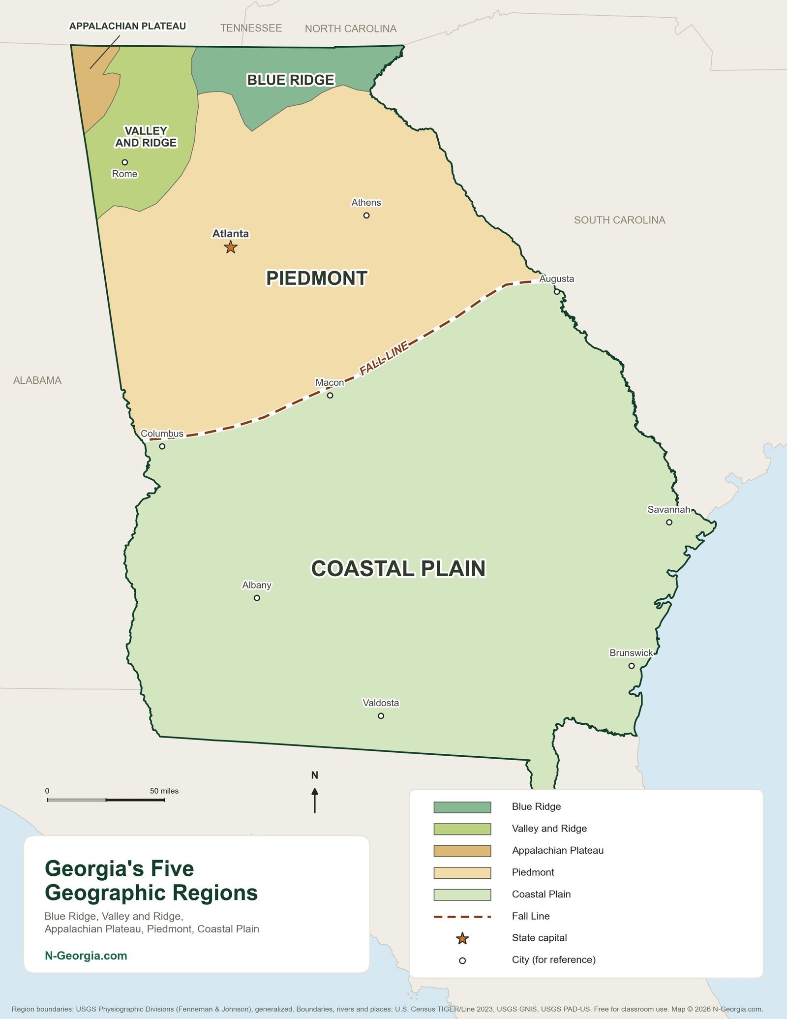
Georgia Regions Map
The Blue Ridge, Valley and Ridge (also called Ridge and Valley), Appalachian Plateau, Piedmont and Coastal Plain, each in its own color, with the Fall Line and reference cities such as Atlanta, Columbus, Macon and Augusta.
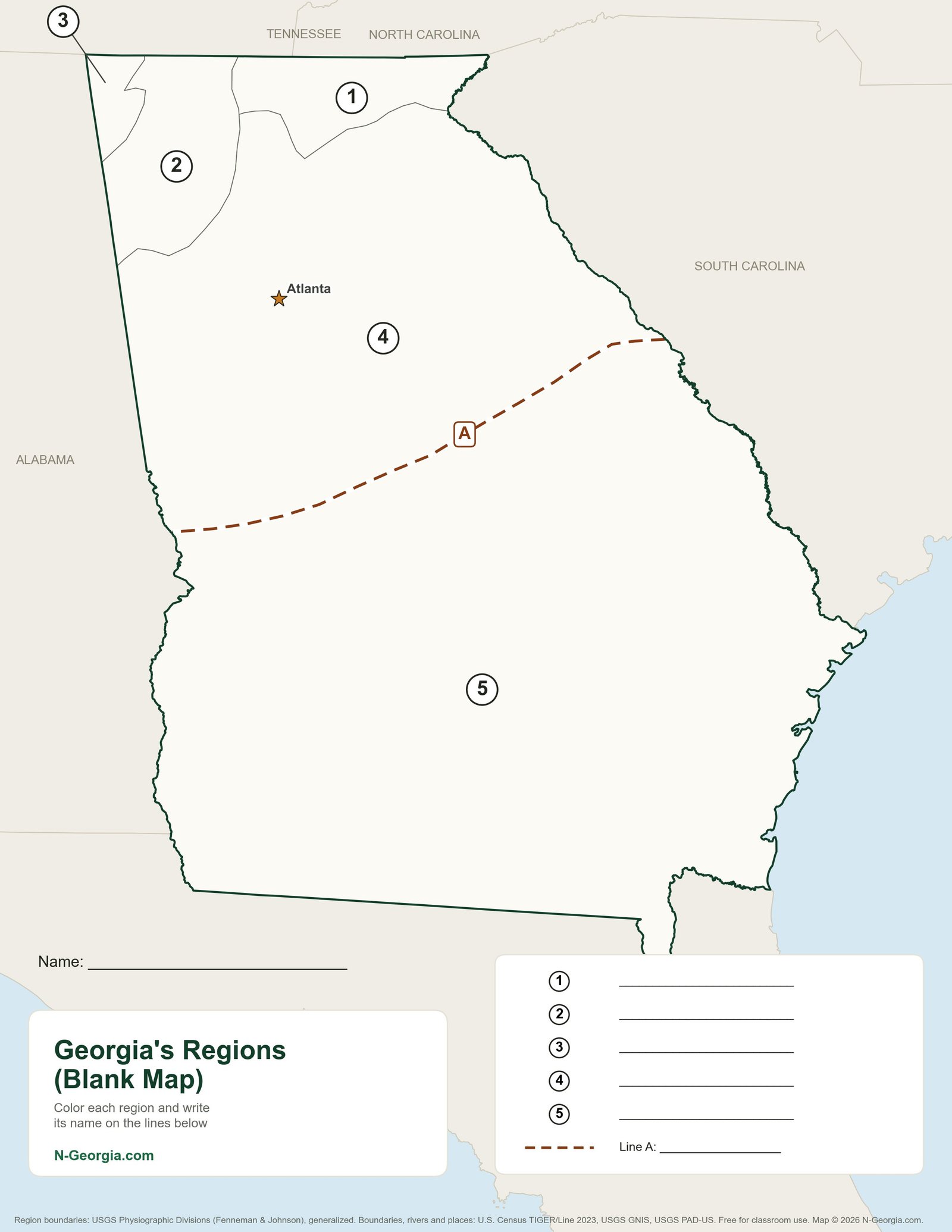
Georgia Regions Blank Map
The same region boundaries with each region numbered 1 to 5 and the Fall Line marked “A,” plus answer lines and a name line. Students color each region and write in its name.
Georgia Physical Features
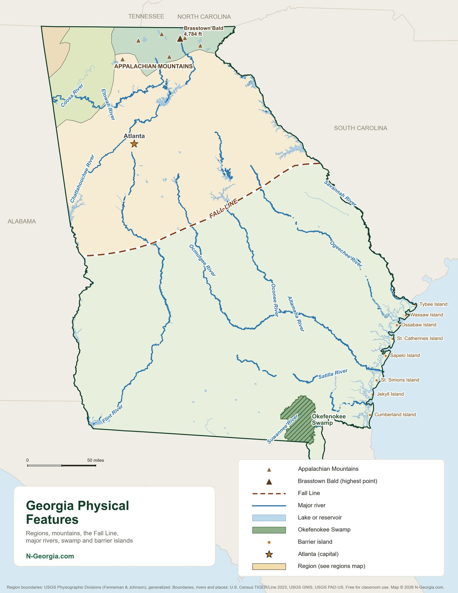
Georgia Physical Features Map
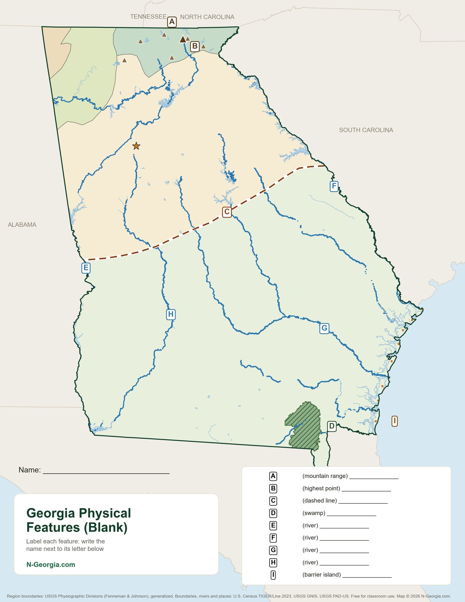
The Appalachian Mountains and Brasstown Bald (4,784 feet), the Fall Line, the Chattahoochee, Flint, Savannah, Altamaha, Ocmulgee, Oconee and other major rivers, the Okefenokee Swamp and the barrier islands from Tybee to Cumberland.
Georgia Physical Features Blank Map
A worksheet version with nine lettered features: the mountain range, the highest point, the Fall Line, the swamp, four rivers and a barrier island, each with a hint and an answer line.
Support Free Maps
These maps are free for every Georgia classroom. Businesses that want to reach Georgia families can sponsor a page; see our advertising options or download the 2026 media kit (PDF).
Blank Outline Maps
Georgia Counties Blank Outline Map
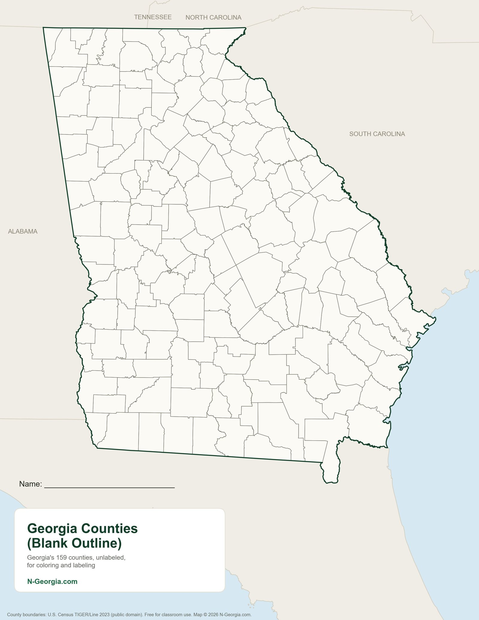
All 159 county boundaries with no labels, for coloring, labeling your home county, or practicing county locations. Pair it with the labeled county map below as an answer key.
Labeled Reference Maps
Georgia County Map
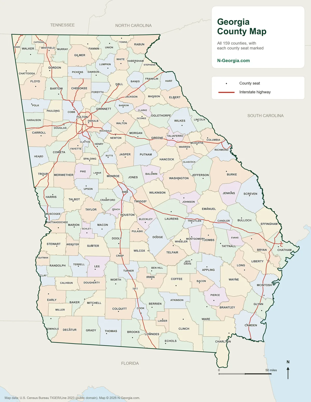
All 159 counties labeled, with each county seat marked. Printable PDF. Every county also has its own printable county map.
Georgia Rivers and Lakes Map
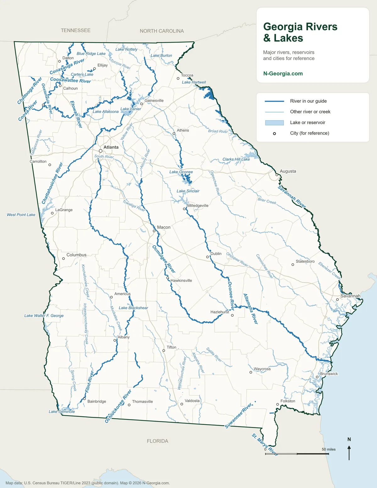
Major rivers, other rivers and creeks and the big reservoirs, labeled. Printable PDF.
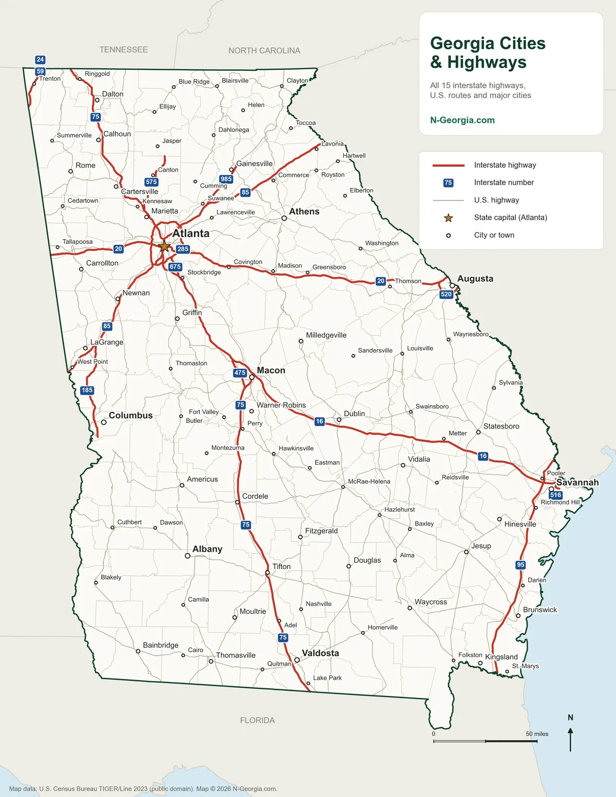
Georgia Cities and Highways Map
Major cities and towns, interstates and U.S. highways. Printable PDF.
For Teachers and Homeschool Families
Standards: The regions and physical features maps cover the features named in Georgia’s social studies standards: the five geographic regions for second grade (SS2G1), and for eighth grade Georgia Studies (SS8G1) the regions plus the Fall Line, Okefenokee Swamp, Appalachian Mountains, Chattahoochee and Savannah rivers and barrier islands. Check your district’s current standards document for exact wording.
Answer keys: Each blank map has a labeled partner on this page. The regions map is the key for the regions blank map, the physical features map is the key for the features worksheet, and the county map is the key for the blank county map.
Using the maps: Print, copy and share them with students freely for classroom and home use, and project them on a smartboard. We ask only that you link to this page (https://www.n-georgia.com/georgia-studies-maps.html) instead of re-hosting the files, so your students always get the current version.
Field trips: Many of the places on these maps make great trips. See Black Rock Mountain for the Blue Ridge, Cloudland Canyon for the Appalachian Plateau, Okefenokee State Park in the Okefenokee Swamp, and our Georgia lighthouses guide for the barrier islands.
Common Questions
What are the five regions of Georgia?
Georgia's five geographic regions are the Blue Ridge in the northeast mountains, the Valley and Ridge (also called Ridge and Valley) in the northwest, the Appalachian Plateau in the far northwest corner, the Piedmont across the middle of the state, and the Coastal Plain, which covers the southern half of Georgia below the Fall Line.
What is the Fall Line in Georgia?
The Fall Line is the boundary between the Piedmont and the Coastal Plain, where the hard rock of the Piedmont meets the softer sediments of the Coastal Plain and rivers drop in waterfalls and rapids. Columbus, Macon and Augusta grew up along it, where boats could travel no farther upstream and the falling water could power mills.
What are Georgia's major physical features?
Georgia's major physical features include the Appalachian Mountains and Brasstown Bald, the state's highest point at 4,784 feet, the Fall Line, the Okefenokee Swamp, the barrier islands along the coast, and major rivers such as the Chattahoochee, Flint, Savannah and Altamaha.
Can teachers print and share these maps?
Yes. The maps are free to print, copy and share with students for classroom and home use, and to project in class. We ask that you link to the page rather than re-hosting the files, so students always get the current version.
Sources we checked
These maps were drawn by N-Georgia.com in October 2026 from public-domain U.S. government data:
- U.S. Geological Survey: Physiographic Divisions of the Conterminous U.S. (Fenneman and Johnson), for region boundaries and the Fall Line, generalized for statewide maps; Geographic Names Information System, for island and summit locations
- U.S. Census Bureau TIGER/Line 2023: state and county boundaries, rivers and lakes
- USGS Protected Areas Database (PAD-US): Okefenokee National Wildlife Refuge boundary, used to show the swamp
- Georgia Standards of Excellence: social studies standards SS2G1 and SS8G1
Spot an error on a map? Email Contact@n-georgia.com and we’ll fix it. Read how we research our guides.