
|
North Georgia's fall color usually runs from early October at the highest elevations down through early November in the valleys, and the state's scenic byways are built specifically to show it off. These are the drives we send people on every year, ranked by how reliably good the color is and how much else there is to see along the way. When to go: Color typically peaks first above 3,000 feet in the second week of October, then moves down the mountains through the month. Weekday mornings avoid both traffic and the worst of the leaf-peeping crowds on these routes. |
|
Sponsor This Guide Put your Georgia business in front of travelers using this guide to plan their trip. See our advertising options or download the 2026 media kit (PDF). |
|
Russell-Brasstown Scenic Byway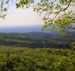
Route length: 41-mile loop Typical peak color: Mid to late October This 41-mile loop through the Chattahoochee National Forest is the single best fall color drive in the state, mostly because a short side trip up the steep GA 180 Spur leads to Brasstown Bald, Georgia's highest mountain at 4,784 feet, where you can see color spread across multiple counties at once from the summit observation tower. The route follows State Highways 348, 180, and 17/75, circling wildlife management areas and the headwaters of the Chattahoochee River, with the Bavarian-themed town of Helen sitting right off the byway if you want a lunch stop. Vogel and Unicoi State Parks are both nearby if you want to turn the drive into an overnight trip. Full route details are on our Russell-Brasstown Scenic Byway page. |
|
Cohutta-Chattahoochee Scenic Byway
Route length: 54-mile route Typical peak color: Mid October Starting at historic Prater's Mill in Whitfield County, this 54-mile route runs past rolling pastureland before opening up to breathtaking views of the Cohutta Mountains. It skirts the town of Chatsworth and climbs State Route 52 past Fort Mountain State Park, one of the most scenic stops in North Georgia for fall color, before ending deep in the Chattahoochee National Forest. It is a longer drive than the Russell-Brasstown loop, so plan for a half day if you want to stop along the way. See our Cohutta-Chattahoochee Scenic Byway page for the full route. |
|
Northeast Georgia Mountains Scenic Tour
Route length: Self-guided driving tour with numbered stops Typical peak color: Mid to late October This self-guided tour strings together small-town history and mountain views, starting at the 1859 Historic White County Courthouse in Cleveland and passing Mt. Yonah, White County's tallest peak at 3,156 feet. It is a good choice if you want a fall drive that mixes color with stops you can actually get out and walk around, rather than a highway loop. A printable map with numbered stops makes it easy to follow. Full stop-by-stop directions are on our Northeast Georgia Mountains Scenic Tour page. |
|
Vogel State Park Loop
Route length: Short scenic loop around Lake Trahlyta Typical peak color: Early to mid October Vogel State Park sits at the base of Blood Mountain and is one of the most photographed fall-color spots in Georgia, with turning leaves reflected in Lake Trahlyta and the surrounding ridgeline lighting up together. It is a short, easy stop rather than a long drive, which makes it a good add-on to either the Russell-Brasstown Byway or a Blood Mountain hike on the same day. See our Vogel State Park page for current conditions. 2026 note: Lake Trahlyta is currently drained for dam repairs, and the Lake Trahlyta Loop Trail and waterfall access are closed. No reopening date has been posted; call the park at 706-745-2628 before you go. |
|
Comparing North Georgia to the Blue Ridge Parkway |
|
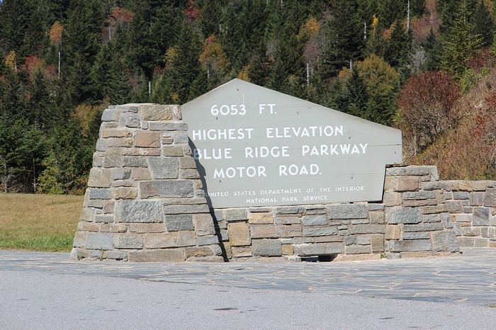
If North Georgia's byways leave you wanting more mountain driving, the famous Blue Ridge Parkway starts just across the state line in North Carolina and Virginia. We wrote a full comparison to help you decide which trip fits your weekend: North Georgia Mountains vs. the Blue Ridge Parkway. |
|
Tips for Fall Color Drives |
|
|
Fill up beforehand: Gas stations thin out once you are deep in the national forest, so top off the tank before starting any of these routes. Check conditions: Georgia's mountain roads can get fog and sudden weather changes in fall. Give yourself daylight to spare, since these are not roads you want to navigate for the first time after dark. Want to get out of the car and hike some of this color up close? See our guide to the best hikes in North Georgia or browse every Georgia scenic driving tour we cover. |
|
Common Questions
When does fall foliage peak in North Georgia?
Fall color in North Georgia typically peaks first above 3,000 feet around the second week of October, then works down the mountains, with lower elevations often peaking in late October to early November.
What is the best scenic drive for fall color in North Georgia?
The 41-mile Russell-Brasstown Scenic Byway loop is our top pick. A short side trip up the GA 180 Spur leads to Brasstown Bald, Georgia’s highest mountain, where the summit observation tower looks out over color in several counties.
Is the Blue Ridge Parkway near North Georgia?
The Blue Ridge Parkway runs through North Carolina and Virginia, north of the Georgia state line. It is a separate trip from North Georgia’s own scenic byways, though both are popular for fall color in the same part of the Appalachians.