
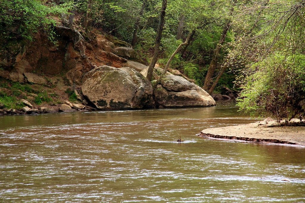
Georgia has more than 12,000 miles of warm-water streams, from cold mountain trout water below Buford Dam to blackwater rivers flowing out of the Okefenokee Swamp. Whether you want to fish, paddle a canoe or kayak, or just relax by the water, start with these river guides.
Teachers and students: see our free printable Georgia regions and physical features maps, with blank versions to label.
Quick answer: The Chattahoochee, about 430 miles, is usually listed as Georgia’s longest river; the longest entirely inside the state is the Flint. Georgia has 14 major river basins and about 70,150 miles of rivers and streams, according to the Georgia Environmental Protection Division. The “Oxbow River” is fictional: it comes from the novel Theo of Golden.
North Georgia Rivers
Chattahoochee River (Buford Dam to Peachtree Creek)
A 48-mile stretch below Lake Lanier that supplies about 70% of metro Atlanta’s drinking water and offers some of north Georgia’s best cold-water trout fishing.
Chattooga River (Northwest Georgia)
Meanders about 51 miles southwest from near LaFayette into Weiss Reservoir, with narrow channels best for kayaks, canoes and light boats.
Conasauga River
Runs about 95 miles from the Cohutta Wilderness through rural north Georgia, with clear mountain water and scenery.
Coosawattee River
Runs about 25 miles from Carters Lake to the Conasauga River; good for full-day paddles and light boats.
Oostanaula River
Winds nearly 50 miles from Calhoun to Rome, where it meets the Etowah to form the Coosa.
Etowah River (Lower)
Flows west about 48 miles from Lake Allatoona to Rome; its shoals make it a favorite with paddlers.
Coosa River
Begins in Rome and flows into Lake Weiss, home to a naturally reproducing striped bass population.
Central Georgia Rivers
Flint River (Upper)
Home of the native shoal bass, with rocky shoals and some of Georgia’s best float trips.
Ocmulgee River (Upper)
From Lloyd Shoals Dam at Lake Jackson through 36 miles of Piedmont shoals to Macon, with shoal bass, catfish and American shad.
Oconee River
From Athens through Lake Oconee and Lake Sinclair to Dublin, with largemouth and Altamaha bass, bream and record blue catfish.
Savannah River
The Georgia-South Carolina line, where oxbow lakes along the lower river offer excellent fishing.
South & Coastal Rivers
Altamaha River
Formed by the Ocmulgee and Oconee, Georgia’s largest free-flowing river, great for tournament bass fishing, paddling and bank fishing.
Flint River (Lower)
Limestone bluffs, blue-hole springs, cypress banks and rocky shoals on the way to Lake Seminole.
Ocmulgee River (Lower)
A winding Coastal Plain river below Macon with bass, bream and catfish.
Ochlockonee River
A lesser-known south Georgia river that is well worth a visit.
St. Marys River
A remote blackwater stream that begins in the Okefenokee Swamp and flows about 130 miles to the Atlantic at the south end of Cumberland Island.
Suwannee River
About 33 miles in Georgia, with dark, tea-stained water flowing out of the Okefenokee Swamp.
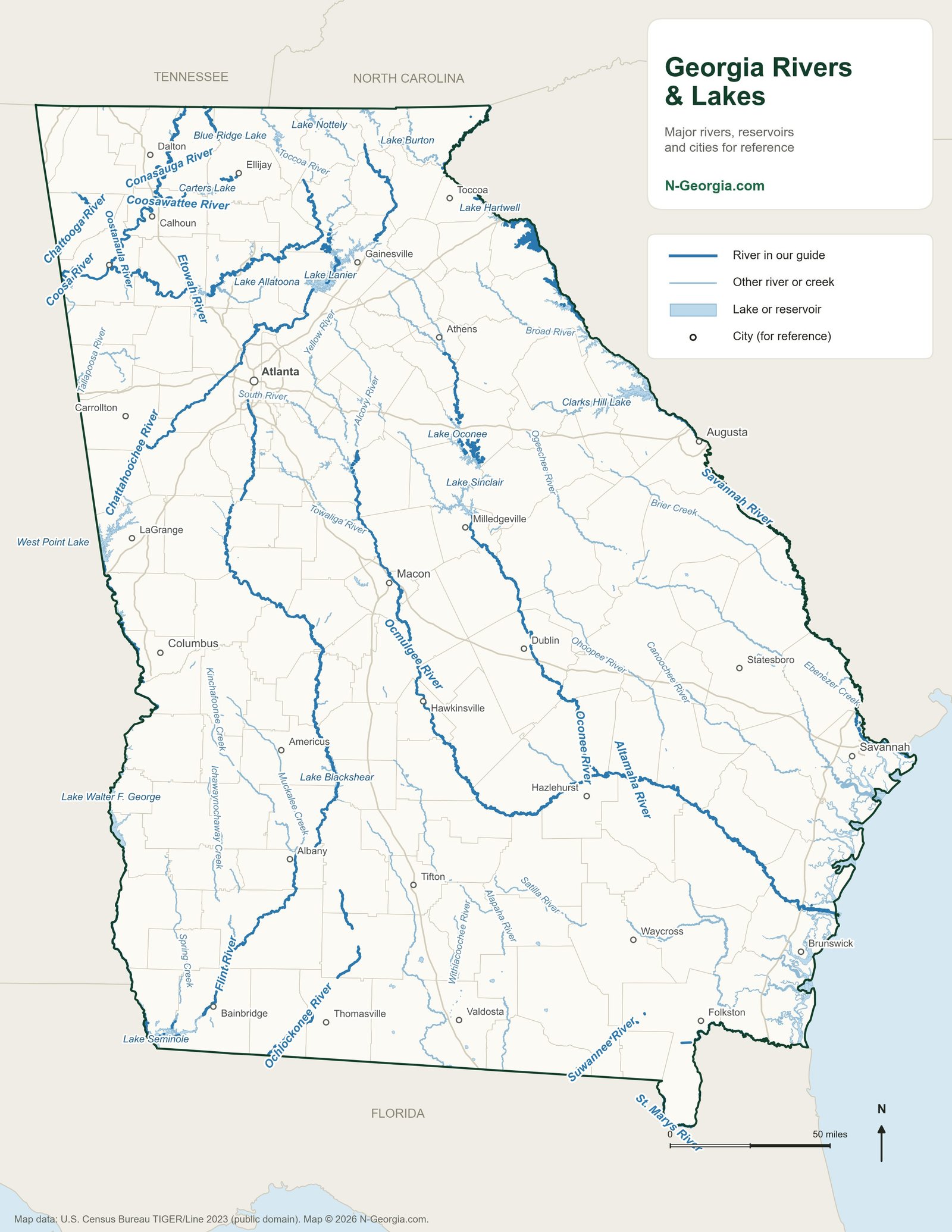
Georgia Rivers Map
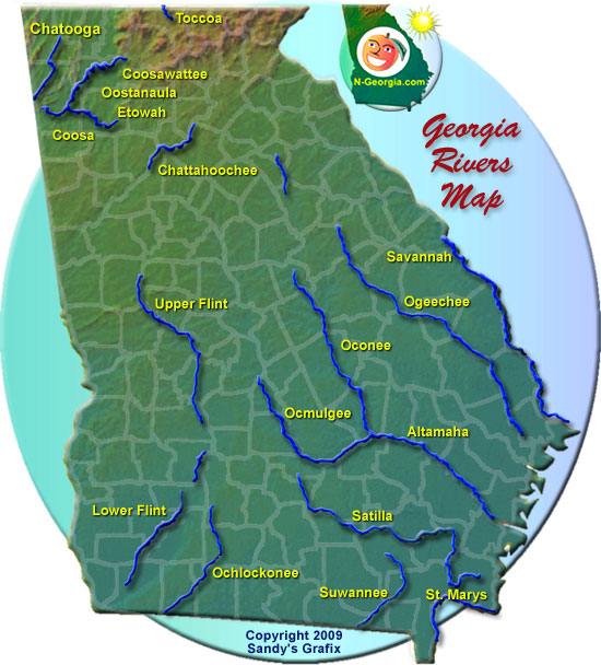
Our Original Rivers Map
Georgia Rivers: Common Questions
What is the longest river in Georgia?
The Chattahoochee is usually listed as Georgia's longest river at about 430 miles. It rises near Jacks Knob in Union County, runs through metro Atlanta and Columbus, forms much of the Georgia-Alabama line, and joins the Flint at Lake Seminole to become the Apalachicola. The longest river entirely inside Georgia is the Flint, nearly 350 miles along its winding channel.
Is there an Oxbow River in Georgia?
No. The Oxbow River in Allen Levi's bestselling novel Theo of Golden flows through the fictional town of Golden, which the author modeled on his hometown of Columbus, on the Chattahoochee. Columbus does have Oxbow Meadows and Oxbow Creek, named for the river's U-shaped bends. Georgia also has real oxbow lakes, such as Montgomery Lake on the Ocmulgee near Jacksonville, where the world-record largemouth bass was caught in 1932.
What are the major rivers in Georgia?
The biggest are the Chattahoochee, Flint, Savannah, Altamaha (formed by the Ocmulgee and Oconee), Ogeechee and the Coosa system (the Etowah and Oostanaula), plus the blackwater St. Marys, Satilla and Suwannee in south Georgia.
Do you need a license to fish Georgia rivers?
Yes. Anglers 16 and older need a Georgia fishing license, and fishing designated trout waters, such as the Chattahoochee below Buford Dam, also requires a trout license.
How many rivers are in Georgia?
Georgia’s rivers drain into 14 major river basins: the Altamaha, Chattahoochee, Coosa, Flint, Ochlockonee, Ocmulgee, Oconee, Ogeechee, St. Marys, Satilla, Savannah, Suwannee, Tallapoosa and Tennessee. The Georgia Environmental Protection Division counts about 70,150 miles of rivers and streams in the state.
Where does the Ocmulgee River start and end?
The Ocmulgee begins below Lake Jackson, southeast of Atlanta, where the Yellow, Alcovy and South rivers flow into the lake. It runs south past Macon and joins the Oconee River about 241 miles downstream to form the Altamaha River.
Sources we checked
Facts in this guide were checked against the agencies and operators that run these places:
- Georgia DNR fishing forecasts – rivers and reservoirs
- Georgia DNR fishing regulations
- New Georgia Encyclopedia: Flint River and Ocmulgee River – river lengths, oxbow lakes, Montgomery Lake
- Columbus Consolidated Government: Oxbow Creek – origin of the Oxbow name
- Allen Levi – Columbus as the model for Golden in Theo of Golden
Each river guide links to Georgia DNR’s current fishing forecast for that river.
Spot something out of date? Email Contact@n-georgia.com and we’ll check it against the official source. Read how we research our guides.