
|
North Georgia's hiking ranges from paved, stroller-friendly paths to a real climb up the highest point on the Appalachian Trail in the state. We sorted this list by difficulty so you can find a trail that actually matches what you want out of the day, whether that is a short walk to a waterfall or a summit view you have to earn. Each trail links to its own full N-Georgia.com page with directions, trail length, and current conditions. |
|
Easy Hikes |
|
West Ridge Falls Access Trail
Trail stats: 0.3 miles, wheelchair accessible Location: Amicalola Falls State Park This short, paved path is one of the easiest ways to see a major North Georgia waterfall up close. It has a gentle slope and a surface coated with recycled tire material, making it wheelchair accessible, and it delivers one of the best views of 729-foot Amicalola Falls of any trail in the park. Full park details are on our Amicalola Falls State Park page. |
|
Anna Ruby Falls Trail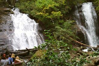
Trail stats: 0.4 miles, paved Location: Unicoi State Park area, near Helen A short, paved, handicap-accessible walk leads to a viewing platform for the twin cascades of Anna Ruby Falls. It is one of the easiest big-payoff hikes on this whole list, which makes it a good choice for families with young kids or anyone who wants a real North Georgia waterfall without a long walk. See our Anna Ruby Falls page for directions. |
|
Moderate Hikes |
|
Tallulah Gorge Rim Trail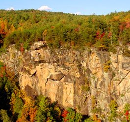
Trail stats: Several miles of connected rim trail, moderate Location: Tallulah Gorge State Park The rim trails along Tallulah Gorge connect a series of overlooks above a canyon that runs two miles long and nearly 1,000 feet deep, with a suspension bridge swaying 80 feet above the gorge floor along the way. No permit is needed for the rim trails, only for the steeper hike down to the gorge floor itself. It is one of the most dramatic moderate hikes in the state for the amount of effort required. More detail is on our Tallulah Gorge State Park page. |
|
Black Rock Mountain Trails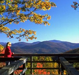
Trail stats: Multiple trails, moderate Location: Black Rock Mountain State Park, Mountain City Black Rock Mountain State Park is the highest state park in Georgia, and its trails reward the climb with 80-mile views across the Southern Appalachians from multiple scenic overlooks. Along the way you will pass wildflowers, small waterfalls, and cascading streams. It is a great choice if you want serious mountain views without a full-day commitment. See our Black Rock Mountain State Park page for trail options. |
|
Vogel State Park Trails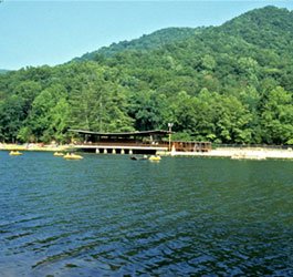
Trail stats: Multiple trails, easy to moderate Location: Vogel State Park, Blairsville Vogel State Park sits at the base of Blood Mountain and is one of the most popular fall-color destinations in the state, with trails winding through a blanket of turning leaves each October. The drive in through Neel Gap, near Brasstown Bald, is scenic on its own. It is an easy park to combine with a Blood Mountain hike on the same trip. More detail is on our Vogel State Park page. |
|
Strenuous Hikes |
|
Blood Mountain via the Appalachian Trail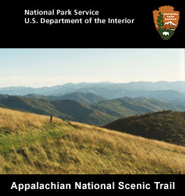
Trail stats: Summit at 4,458 feet, strenuous Location: Blood Mountain Wilderness, near Blairsville At 4,458 feet, Blood Mountain is the highest point on the Appalachian Trail in Georgia, and the climb to its rocky, mostly open summit is one of the most rewarding strenuous hikes in the state. The surrounding wilderness area also holds 27 miles of trout streams and rugged rock outcroppings. Most hikers start from Neel Gap for the shortest route to the top. See our full comparison of Blood Mountain versus Springer Mountain if you are deciding which peak to tackle first, or visit our Blood Mountain Wilderness page for trail access points. |
|
Appalachian Approach Trail from Amicalola Falls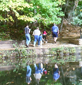
Trail stats: 8.5 miles to Springer Mountain, strenuous Location: Amicalola Falls State Park This is the trail thousands of Appalachian Trail thru-hikers walk every year to reach the official southern terminus at Springer Mountain. The first mile alone includes a 604-step staircase up alongside the falls, and the full approach runs 8.5 miles with steep, sustained climbing. Even a partial hike up the staircase gives a serious workout and a close-up look at Amicalola Falls. Full details are on our Amicalola Falls State Park page. |
|
Cloudland Canyon Trails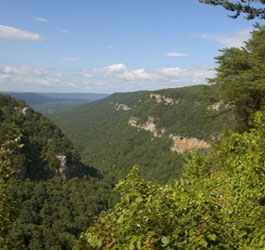
Trail stats: Multiple trails across 3,485 acres, moderate to strenuous Location: Cloudland Canyon State Park, Rising Fawn On the western edge of Lookout Mountain, Cloudland Canyon's trails drop from 1,980 feet down into a deep gorge cut by Sitton Gulch Creek, with waterfall trails that involve real elevation change in both directions. It is one of the most geologically dramatic parks in the state and a good pick if you want a strenuous hike that ends at a waterfall rather than a summit. See our Cloudland Canyon State Park page for current trail conditions. |
|
How to Pick the Right Hike |
|
|
If you are new to North Georgia hiking, start with an easy trail like Anna Ruby Falls before attempting something like Blood Mountain. The mountain terrain here is steeper and rockier than it looks on a map, and afternoon thunderstorms are common in summer. Always check current trail and weather conditions before you head out, wear real hiking shoes, and carry more water than you think you need. Looking for waterfalls specifically? See our 10 Best Waterfalls in North Georgia guide, or browse every trail we cover on the Hiking Trails hub page. |
|