
Statewide Georgia maps for trip planning: highways and counties, state and county parks, lakes and rivers, wildlife areas, the Appalachian Trail, covered bridges and Civil War sites. Many print well, and several are interactive.
Statewide Maps

Georgia Cities & Highways
All 15 interstates, U.S. highways and 99 cities statewide. Printable PDF

Atlanta Highways & Airports
The 29-county metro: interstates, the Perimeter, cities and airports. Printable PDF
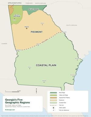
Georgia Regions
Georgia's five geographic regions and the Fall Line. Printable PDF
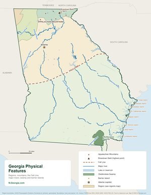
Georgia Physical Features
Mountains, the Fall Line, rivers, the Okefenokee Swamp and barrier islands. Printable PDF
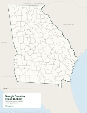
Blank Georgia Maps
Blank county, region and physical features maps to color and label. Printable PDF

Georgia Counties
All 159 counties with county seats. Printable PDF

State Parks
46 state parks plus 4 former state parks, each clickable. Printable PDF
County Parks
County and city parks, county by county.

Lakes & Rivers
Major lakes and rivers for boating and fishing. Printable PDF

WMA & WRD Sites
Wildlife management areas and DNR sites.

Appalachian Trail
The AT in Georgia, Springer Mountain to Bly Gap.

Covered Bridges
Georgia’s historic covered bridges. Printable PDF

Coast & Barrier Islands
Beaches and islands from Tybee to Cumberland.

Civil War Sites
Battlefields and historic sites statewide.

Atlanta Civil War Sites
The 1864 Atlanta Campaign around the city.

Visitor Information Centers
Georgia’s state welcome centers.
Georgia’s 9 Travel Regions
Each region guide includes things to do, and each has a printable region map.

North Georgia
Both mountain regions on one map: 34 counties, towns, lakes, state parks and peaks. Printable PDF

Metro Atlanta
Region guide and printable map. Printable PDF

NE Georgia Mountains
Region guide and printable map. Printable PDF

Historic High Country
Region guide and printable map. Printable PDF

Coast & Islands
Region guide and printable map. Printable PDF

Classic South
Region guide and printable map. Printable PDF

Historic Heartland
Region guide and printable map. Printable PDF

Magnolia Midlands
Region guide and printable map. Printable PDF

Plantation Trace
Region guide and printable map. Printable PDF

Presidential Pathways
Region guide and printable map. Printable PDF
Directories
Chambers of commerce, welcome centers, visitor centers and CVBs, Wildlife Resources Division sites, list of all 537 cities and towns in Georgia, with populations and Georgia counties and county seats.
Sources we checked
Facts in this guide were checked against the agencies and operators that run these places:
- Georgia Department of Transportation maps – official highway and county maps
- Georgia State Parks map – every state park and historic site
- Georgia DNR interactive map – WMAs, public fishing areas and ranges
- Georgia DNR wildlife management areas – WMA list and maps
- National Park Service in Georgia
- Appalachian Trail Conservancy, Georgia
Our illustrated maps were drawn for N-Georgia.com by founder Sandy Earon and are meant for trip planning. For navigation, road closures and property boundaries, use the official maps above.
Spot something out of date? Email Contact@n-georgia.com and we’ll check it against the official source. Read how we research our guides.