
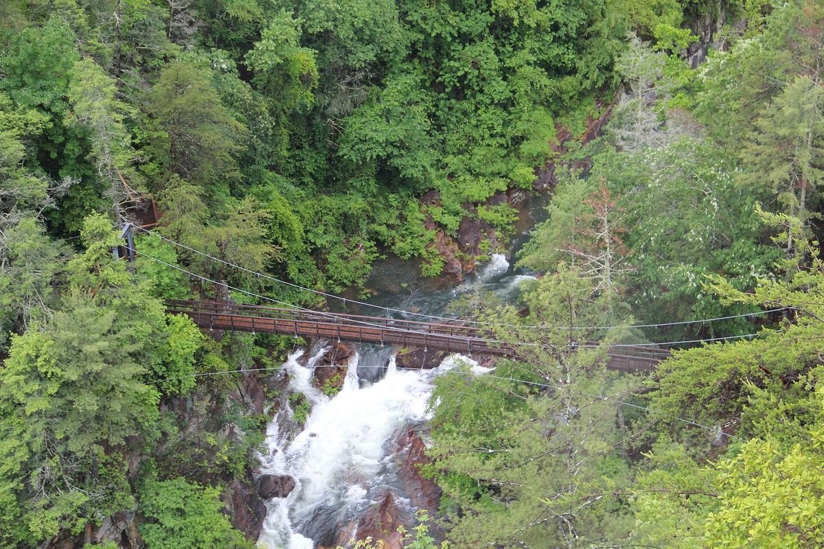
Photo: Thomson200, public domain, via Wikimedia Commons
Tallulah Gorge is 2 miles long and nearly 1,000 feet deep. You can hike rim trails to several overlooks, or obtain a free permit to hike down to the gorge floor.
- Address338 Jane Hurt Yarn Drive, Tallulah Falls, GA 30573
- Park Hours8 a.m. – dark
- Interpretive Center Hours8 a.m. – 5 p.m.
- Parking Fee$10 per vehicle (ParkPass)
- Park Phone706-754-7981
- Camping706-754-7979
- Picnic Shelters706-782-4014
- GPS CoordinatesN 34.739750, W -83.395233
All visitors must register at the Visitor Center. Located on U.S. Hwy. 441 within the city limits of Tallulah Falls, Georgia.
A suspension bridge sways 80 feet above the rocky bottom, providing spectacular views of the river and waterfalls. Exhibits in the park's Jane Hurt Yarn Interpretive Center highlight the rich history of this Victorian resort town, along with the rugged terrain and fragile ecosystem of the area, and an award-winning film takes viewers on a dramatic journey through the gorge.
Permits are required for anyone accessing the gorge floor or rock climbing/rappelling. The only approved trail for entering or leaving the gorge floor is the Hurricane Falls staircase, and both the staircase and gorge floor are very strenuous – visitors with health problems should not attempt them, and children must be closely supervised at all times.
Tallulah Gorge State Park is operated through a public-private partnership with Georgia Power Company; many facilities, including the campground, are run by Georgia Power rather than the Department of Natural Resources (marked * below – the Friends discount is not honored at these). Due to access restrictions on private property, the original Sliding Rock Trail is closed; Sliding Rock pool is now reached by hiking the Hurricane Falls staircase, and a gorge floor permit is required.
Park Amenities
- 473 acres of state park land
- 63-acre lake with seasonal beach*
- 52 tent, trailer & RV campsites*
- 2 backcountry Adirondack shelters
- Picnic shelter*
- 1 Pioneer Campground
- Interpretive Center & film
- Gorge overlooks
- Suspension bridge
- Tennis courts*
- Picnic tables*
- Gift shop
Recreational Activities
- GeoCaching
- Whitewater & aesthetic water releases
- 20+ miles of hiking & mountain biking
- 1.7-mile paved Rails to Trails path
- Swimming
- Fishing
- Picnicking
- Ranger programs
- Archery
Hiking and mountain biking includes the Canyon Climbers Club and Muddy Spokes Club; a free permit is required for gorge floor access.
Permits & Trail Notes
Gorge Floor Permits
Free, available at the Interpretive Center. Proper footwear required (no flip-flops or crocs); issued after safety briefings at 8 a.m., 10 a.m. and noon while supplies last, limited to 100 per day and not transferable. Groups of 20 only on weekends, groups of 30 only on weekdays; no groups larger than 30. Weather and water flow can restrict access.
High Bluff & Stoneplace Trails
A moderately difficult out-and-back system: a 2-mile, moderately technical High Bluff Trail leads into older road beds that become the Stoneplace Trail, descending to the Stoneplace boat ramp on Lake Tugalo (a primitive lake formed by the Chattooga and Tallulah rivers). The return trip is all uphill.
Pet Rules
For animals' safety, pets are not allowed on the gorge floor or any trail accessing it. Leashed pets are still welcome on the rim trails.
Hunting Season
Mid-September through January 1. Stoneplace Trail permits are not issued until after 10 a.m. during this period, and hikers/bikers are encouraged to wear reflective orange.
Water Flow
A typical day runs 35-40 CFS. Aesthetic releases raise it to 200 CFS; whitewater releases hit 500 CFS on Saturdays and 700 CFS on Sundays.
Photos
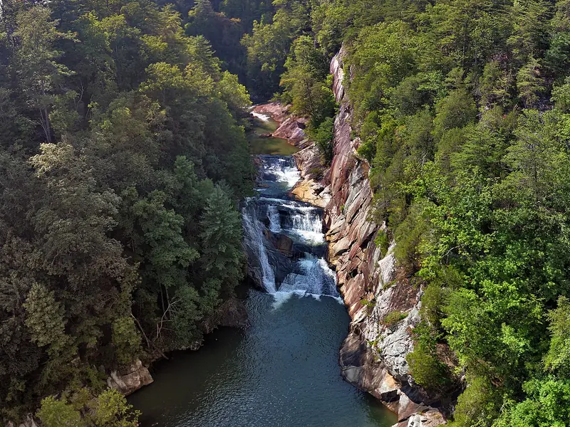 The Gorge & Falls2 miles long, nearly 1,000 feet deep
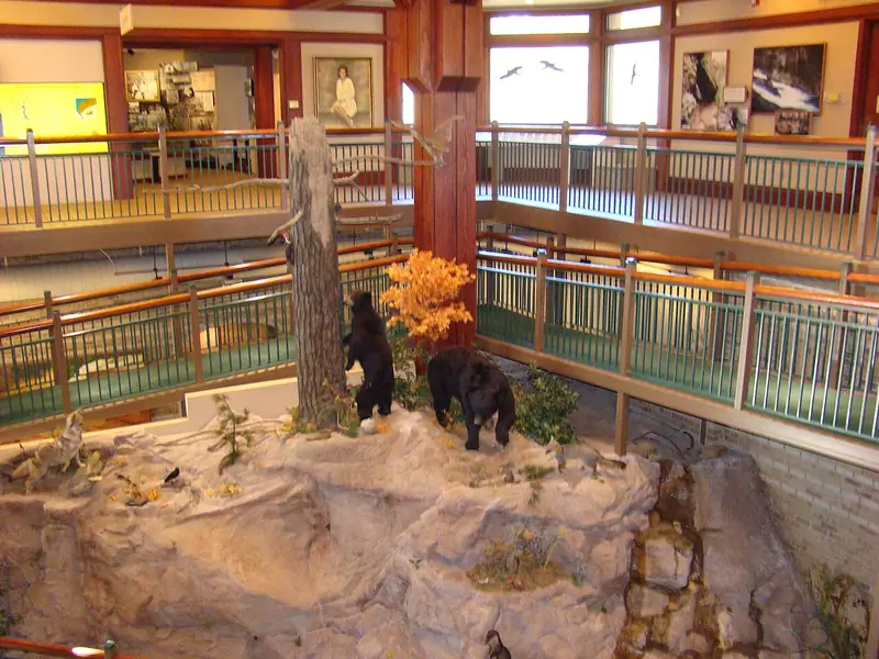 Interpretive CenterExhibits on the gorge's history
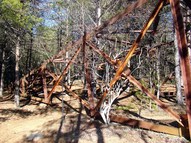 Wallenda TowerWhere Karl Wallenda crossed in 1970
Photos via Wikimedia Commons: anonymouse1, CC BY-SA 3.0; FloNight (Sydney Poore) and Russell Poore, CC BY-SA 4.0; FloNight (Sydney Poore) and Russell Poore, CC BY-SA 4.0.

Tallulah Gorge State Park Video
