
Cities in metro Atlanta, with populations
See all 67 cities and suburbs in the core metro counties with county and 2024 population, or browse all 537 Georgia cities and towns.
All 159 Georgia counties
Every county with its county seat, in one list.
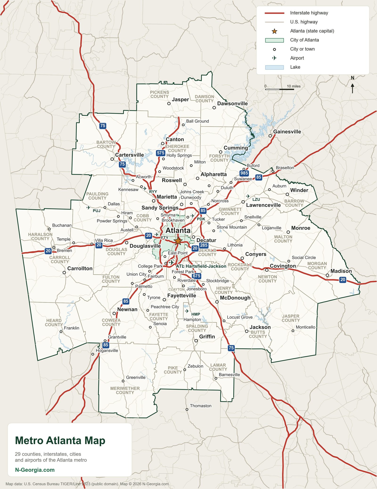
Metro Atlanta is a big, sprawling place, and the perimeter loop (I-285) confuses even folks who have lived here for years.
This map lays out the interstates, the main airports, and the counties that make up the metro area so you can see how Cobb, Fulton, DeKalb, Gwinnett and the rest fit together before you get on the road. It is a good starting point whether you are driving in for a game, a concert, or just visiting family, and it pairs well with our statewide highway map if your trip continues past the metro area.
Metro Atlanta Interstates
| Route | Where it goes |
|---|---|
| I-75 | North-south through downtown; the main route to and from Chattanooga, TN to the north and Macon and Valdosta to the south |
| I-85 | Northeast-southwest through downtown; the main route to and from Greenville, SC and LaGrange and Alabama to the south |
| I-20 | East-west through downtown, connecting to Augusta in the east and Birmingham, AL in the west |
| I-285 | The Perimeter: a full loop around the metro area, connecting I-20, I-75 and I-85 |
| I-575 | North from I-75 in Kennesaw into Cherokee and Pickens counties |
| I-675 | A shortcut from I-285 south to I-75 at Stockbridge, through Clayton and Henry counties |
| I-985 | North from I-85 near Suwanee to Gainesville and Lake Lanier |
Metro Atlanta Airports
Hartsfield-Jackson Atlanta International (ATL)
6000 N Terminal Parkway, Atlanta, GA 30320
The world’s busiest passenger airport and Atlanta’s main commercial hub.
DeKalb-Peachtree Airport (PDK)
2000 Airport Road, Atlanta, GA 30341
General aviation airport in Chamblee, north of downtown.
Fulton County Airport – Brown Field (FTY)
3952 Aviation Cir NW, Atlanta, GA 30336
General aviation airport on the west side of Atlanta.
Cobb County International – McCollum Field (RYY)
1723 McCollum Pkwy NW, Kennesaw, GA 30144
General aviation airport serving Cobb County.
Gwinnett County Airport – Briscoe Field (LZU)
600 Briscoe Blvd, Lawrenceville, GA 30046
General aviation airport serving Gwinnett County.
Paulding Northwest Atlanta Airport (PUJ)
730 Airport Parkway, Dallas, GA 30157
General aviation airport west of the metro area.
Atlanta Speedway Airport (HMP)
Hampton, GA (Henry County)
General aviation airport south of the metro area, formerly known as Tara Field.
Metro Atlanta Counties
The 29 counties of the Atlanta metropolitan statistical area. Tap a county for its parks and things to do.
- Barrow County
- Bartow County
- Butts County
- Carroll County
- Cherokee County
- Clayton County
- Cobb County
- Coweta County
- Dawson County
- DeKalb County
- Douglas County
- Fayette County
- Forsyth County
- Fulton County
- Gwinnett County
- Haralson County
- Heard County
- Henry County
- Jasper County
- Lamar County
- Meriwether County
- Morgan County
- Newton County
- Paulding County
- Pickens County
- Pike County
- Rockdale County
- Spalding County
- Walton County
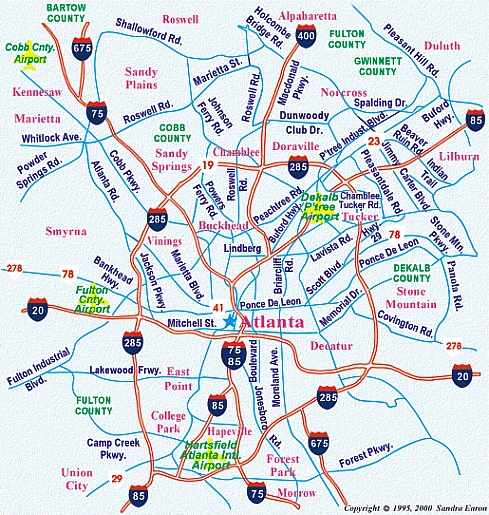
Our Original Metro Atlanta Map
Visiting for the holidays? See the best Christmas lights in Atlanta, from Stone Mountain and the Botanical Garden to Lights of Life in Marietta and the Lanier Islands drive-through.
More Georgia Maps
- GA Cities & Highways Map
- GA Counties Map
- North Georgia Map
- GA State Parks Map
- GA WRD & WMA Sites Map
- GA Lakes & Rivers Map
- GA Covered Bridges Map
- Atlanta Civil War Sites Map
- GA Civil War Sites Map
- GA Appalachian Trail Map
- Metro Atlanta Travel Region
Looking for a job in Atlanta? Whatever field you are in, we have the right staffing agency information just for you. Find a staffing agency or job in Georgia.
Popular Metro Atlanta Guides
See the list of cities in metro Atlanta and the full list of cities in Georgia, plus guides to the parks and malls people look up most.
Parks
- Welcome All Park, South Fulton
- Sandtown Park, South Fulton
- Cliftondale Park, South Fulton
- Yellow River Park, Stone Mountain
- McDaniel Farm Park, Duluth
- Sawnee Mountain Preserve, Cumming
- Central Park, Cumming
- Bennett Park, Cumming
- Young Deer Creek Park, Lake Lanier