
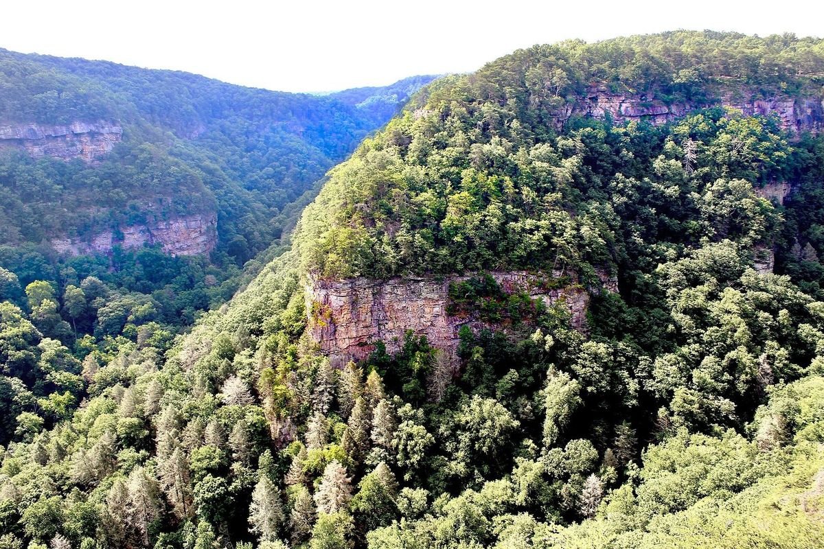
Photo: Andy Montgomery, CC BY-SA 2.0, via Wikimedia Commons
Northwest Georgia’s Historic High Country is a land of ridges, valleys and history. Chickamauga and Chattanooga National Military Park, the nation’s first national military park, preserves the 1863 battlefield; Ringgold Gap and Rocky Face Ridge mark the 1864 Atlanta Campaign; and New Echota was the capital of the Cherokee Nation. Add canyon hikes, mountain lakes and small-town festivals, and there is plenty to fill a weekend.
Planning a trip? Start with the 20 best things to do in North Georgia and our guide to the 10 best North Georgia mountain towns.
Explore the Historic High Country
Free Things To Do Outdoors
Parks, trails, farms, fish hatcheries, wetlands and Civil War sites.
Free Things To Do Indoors
Art centers, museums, historic sites and historical societies.
Festivals & Events
Festivals, fairs, concerts and holiday events around the region.
Fishing Lakes
Small public and private lakes for fishing, swimming and boating.
Museums & Galleries
Tellus Science Museum, Oak Hill & the Martha Berry Museum, Fort Oglethorpe’s 6th Cavalry collection and more.
Christmas Lights
The best holiday light displays in northwest Georgia.
Visitor Centers
Chambers, welcome centers and CVBs that will mail maps and guides.
State Parks & Historic Sites
Cloudland Canyon State Park
3,538 acres on the western edge of Lookout Mountain, with canyon rim trails and waterfalls.
Fort Mountain State Park
Named for a mysterious 855-foot stone wall on the mountaintop near Chatsworth.
Red Top Mountain State Park
Trails, cottages and camping on 12,000-acre Lake Allatoona near Cartersville.
James H. (Sloppy) Floyd State Park
561 quiet acres near Summerville with two stocked fishing lakes.
John Tanner Park
A county-run park near Carrollton known for its big sand swimming beach.
New Echota Cherokee Capital
Capital of the Cherokee Nation and home of the Cherokee Phoenix, the first Native American newspaper.
Chief Vann House
The 1804 brick home of Cherokee leader James Vann, near Chatsworth.
Etowah Indian Mounds
One of the most intact Mississippian culture sites in the Southeast, near Cartersville.
Pickett’s Mill Battlefield
Walk the roads, earthworks and ravine of the May 27, 1864, battle near Dallas.
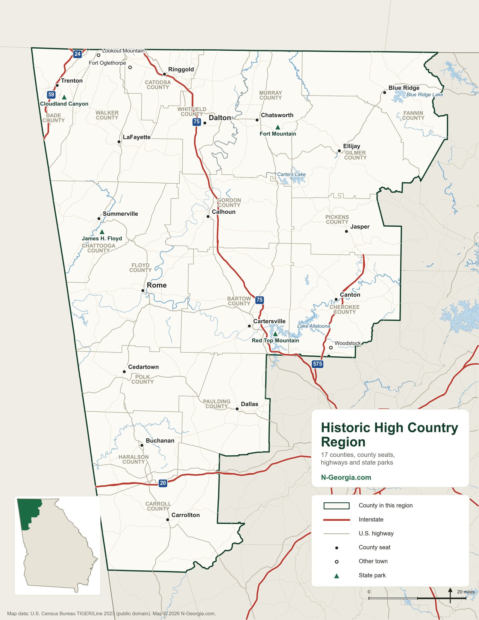
To see the Historic High Country and the Northeast Georgia Mountains together, with lakes, peaks and every state park in both regions, use our North Georgia map.
Towns in the Region
Adairsville, Aragon, Ball Ground, Big Canoe, Blue Ridge, Bremen, Buchanan, Calhoun, Canton, Carrollton, Cartersville, Cassville, Cave Spring, Cedartown, Chatsworth, Cherry Log, Chickamauga, Cloudland, Cohutta, Crandall, Dallas, Dalton, East Ellijay, Ellijay, Eton, Euharlee, Fairmount, Fort Oglethorpe, Hinton, Hiram, Jasper, Kingston, LaFayette, Lookout Mountain, McCaysville, Mineral Bluff, Morganton, Nelson, Oakman, Resaca, Ringgold, Rising Fawn, Rock Spring, Rockmart, Rocky Face, Rome, Rossville, Rydal, Sugar Valley, Summerville, Talking Rock, Tallapoosa, Tate, Temple, Trenton, Trion, Tunnel Hill, Villa Rica, Waco, Waleska, White, Whitesburg, Wildwood, Winston and Woodstock.
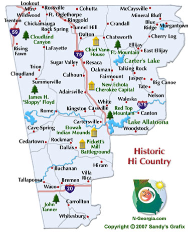
Our Original Historic High Country Map
Sources we checked
Facts in this guide were checked against the agencies and operators that run these places:
- Georgia State Parks & Historic Sites
- Chickamauga & Chattanooga National Military Park
- New Georgia Encyclopedia – regional history
Spot something out of date? Email Contact@n-georgia.com and we’ll check it against the official source. Read how we research our guides.