
Cool off in Georgia’s beautiful sparkling lakes and rivers. Stay and play in Georgia!
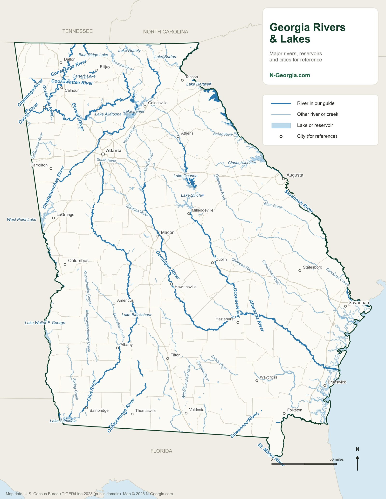
Georgia is one of the best-watered states east of the Mississippi, with more than 70,000 miles of streams and rivers and dozens of major lakes formed by dams built for flood control, power and drinking water. This map is our quick reference for where the water is. Click through to find boat ramps, marinas, swimming beaches and fishing spots on the lake or river nearest you, and check out our rivers guide and lakes guide for more detail on each one.
Georgia Lakes Directory
Lake Sidney Lanier
Large Chattahoochee River reservoir in the Blue Ridge foothills, formed by Buford Dam, one of the most-visited lakes in the Southeast.
Allatoona Lake
U.S. Army Corps of Engineers lake near Cartersville, one of the most visited Corps lakes in the nation with over 6 million visitors a year.
Carters Lake
Located between Calhoun and Ellijay in the North Georgia Blue Ridge foothills, known for its rugged shoreline scenery.
Lake Hartwell
Reservoir on the Savannah River along the GA/SC line, with Corps of Engineers campgrounds including Coneross and Crescent Group Camp Park.
Lake Oconee
19,050 acres and 374 miles of shoreline, mainly in Greene County near Madison and Greensboro, operated by Georgia Power.
Lake Sinclair
One of Georgia's most popular boating and fishing lakes, downstream of Lake Oconee with ample lakeside camping.
Lake Seminole
376 miles of shoreline at the Georgia-Florida-Alabama tri-state line, nationally known for sport fishing.
Lake Blue Ridge
3,290-acre TVA reservoir on the Toccoa River near Blue Ridge, GA, formed by a dam completed in 1930.
Lake Burton
2,775-acre Georgia Power reservoir near Clayton, known for scenic lakeside homes and quality spotted bass fishing.
Lake Rabun
Small mountain lake in the North Georgia mountains with a Forest Service recreation area for camping, swimming and boating.
West Point Lake
25,900-acre Army Corps of Engineers reservoir extending 35 miles along the Chattahoochee River on the Alabama-Georgia line.
Lake Jackson
4,750-acre Georgia Power lake near Jackson, GA, formed where the Alcovy, South and Yellow Rivers meet.
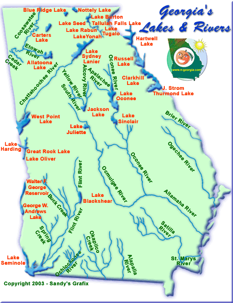
Our Original Lakes and Rivers Map
Common Questions
What are the largest lakes in Georgia?
By surface area, the largest are Clarks Hill Lake (J. Strom Thurmond Lake, more than 70,000 acres), Lake Hartwell (56,000), Lake Walter F. George (about 45,000), Lake Lanier (38,000), Lake Seminole (37,500), Lake Russell (26,650), West Point Lake (25,900), Lake Oconee (19,050), Lake Sinclair (15,330) and Lake Allatoona (12,010). Clarks Hill, Hartwell and Russell are shared with South Carolina, Walter F. George and West Point with Alabama, and Seminole with Florida, which makes Lake Lanier the largest lake entirely inside Georgia. Acreage figures are from the Georgia Department of Natural Resources.
Are Georgia’s big lakes natural?
No. Georgia’s largest lakes are all reservoirs formed by dams on its rivers, built by the U.S. Army Corps of Engineers or Georgia Power. In all, Georgia has more than 425,000 acres of lakes, according to the Georgia Department of Natural Resources.