
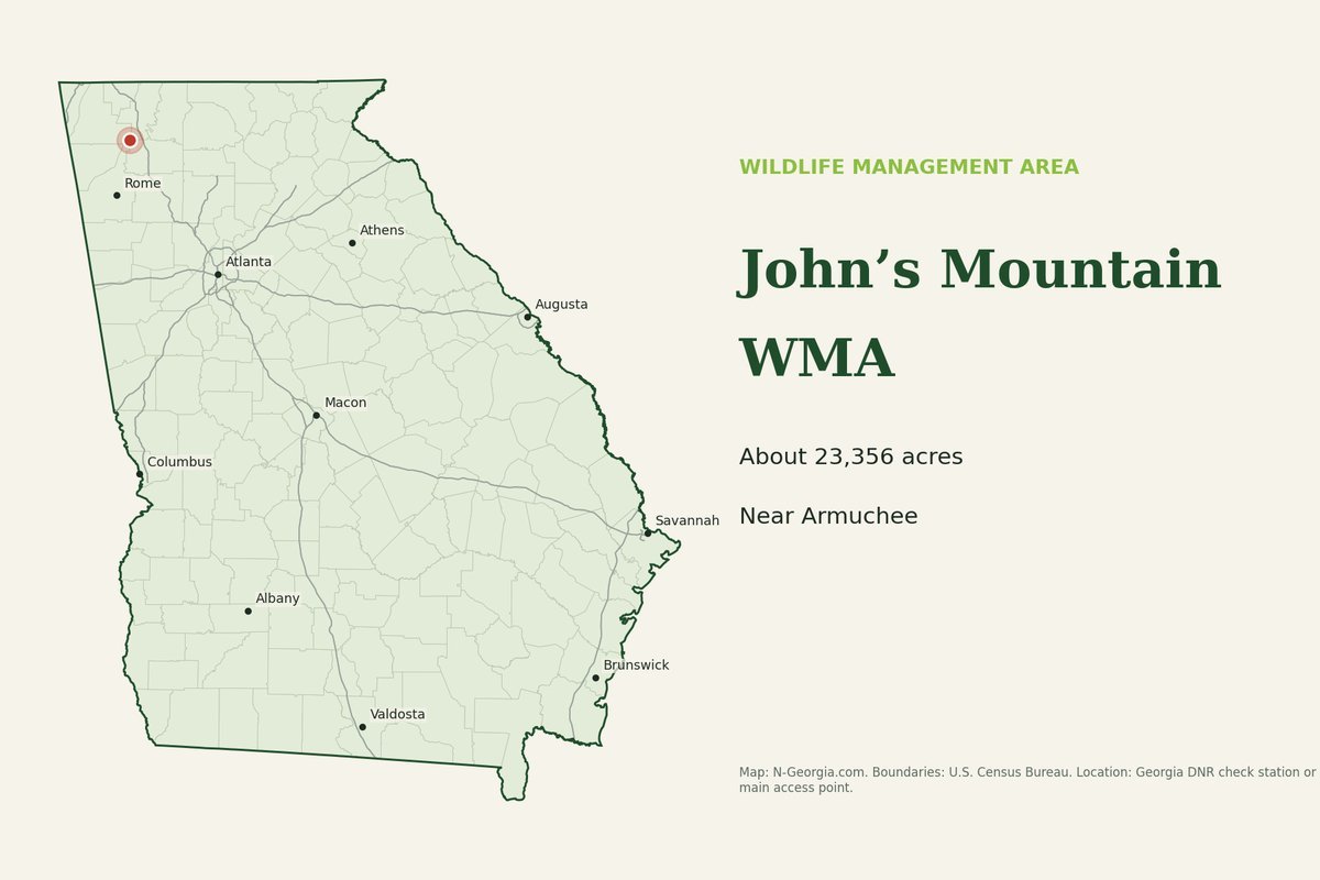
Map: N-Georgia.com, built from U.S. Census Bureau boundaries; location from Georgia DNR
John’s Mountain WMA covers 23,356 acres of the Chattahoochee National Forest in Walker, Whitfield, Gordon and Floyd counties, near Armuchee. It is hunted for deer, bear, turkey and small game, and has the Chestnut Mountain shooting range, primitive campsites and hiking, biking and horse trails. ATVs are not allowed.
Current notice from Georgia DNR
Forest roads 995E and 955B are temporarily closed (DNR update, April 10, 2026).
- SizeAbout 23,356 acres
- Check station / access9 Lake Marvin Road NE Armuchee, GA 30105
- GPS34.61407, -85.06490
- Georgia DNR officeRegion 1 office, 706-295-6041
2026-27 Hunting Seasons at John’s Mountain WMA
These dates come from Georgia DNR’s 2026-27 WMA regulations. “State seasons” means the statewide dates apply; see our Georgia hunting seasons guide. Sign-in is required for bear, deer and turkey hunts unless noted, and quota hunts require an application at GoOutdoorsGeorgia.com.
| Game | Season | 2026-27 dates and rules |
|---|---|---|
| Deer & bear | Archery | Sept. 12-Oct. 23, Oct. 26-Nov. 11, Nov. 15-Dec. 25 |
| Deer & bear | Firearms | (bonus deer hunt) Oct. 24-25 |
| Deer & bear | Firearms | Either-Sex Last Day: (bonus deer hunt) Nov. 12-14 |
| Deer & bear | Firearms | Buck Only: (bonus deer hunt) Dec. 26-Jan. 1 |
| Turkey | Apr. 3-May 15 | |
| Coyote | May 16-31 | |
| Small Game | State Seasons | |
| Small Game | Quail | Jan. 2-31 |
| Waterfowl | State Seasons |
Advertise Near Here
Outfitters, guides, lodging and processors: reach hunters planning a Georgia season. See our advertising options or download the 2026 media kit (PDF).
John’s Mountain WMA Maps
For current boundaries, roads, gates and food plots, use Georgia DNR’s John’s Mountain WMA page and its interactive property map, which also works in the Outdoors GA app. Our printable PDF maps below are older copies of DNR maps from roughly 2011 to 2013; boundaries, roads and tract names may have changed since.
Area Rules & Directions
- No ATVs. Electric bicycles restricted to roads open for motor vehicles.
- Forest Service campgrounds and the shooting range are cashless: pay through Recreation.gov and keep proof of payment, since cell service is poor.
Directions. From Calhoun: Take HWY 136C north 6 miles to Sugar Valley, turn left and go 6 miles to Lake Marvin, check station is at The Pocket.
Everyone 16 and older entering a WMA needs a Georgia license that allows hunting or fishing, or a Lands Pass ($30 a year for residents). Wear fluorescent orange or blaze pink during firearms and primitive weapons deer and bear hunts, and report deer, bear and turkey through Georgia Game Check within 24 hours.
Facilities & Things to Do
Facilities
Bike Trails; Chestnut Mountain Shooting Range; Equestrian Trails; Hiking Trails; Nature Trails; Picnic Shelters; Picnic Sites; Primitive Campsites.
Activities
Biking; Hiking Trails; Horseback Riding; Hunting (including specialty hunts); Primitive Camping; River Fishing; Shooting; Wildlife Viewing.
Nearby Public Land
Allatoona WMA, Arrowhead WMA, Berry College WMA, Chief Vann House State Historic Site, Cohutta WMA, Conasauga River WMA, Coosawattee WMA, Carter's Lake WMA, Crockford Pigeon Mountain WMA, Dawson Forest WMA, Etowah Indian Mounds State Historic Site, New Echota State Historic Site, Otting WMA, Paulding Forest WMA, Rich Mountain WMA, Rich Mountain WMA: Cartecay Tract, Rocky Mountain PFA, Summerville Trout Hatchery, Sheffield WMA, Zahnd WMA.
More WMAs
See the Northwest Georgia WMAs page, the statewide WMA map and our deer, dove and duck season guides.
Common Questions
When is deer season at John’s Mountain WMA in 2026-27?
Under the 2026-27 regulations, John’s Mountain WMA deer hunts are: Archery: Sept. 12-Oct. 23, Oct. 26-Nov. 11, Nov. 15-Dec. 25; Firearms: Oct. 24-25; Firearms: Either-Sex Last Day: Nov. 12-14; Firearms: Buck Only: Dec. 26-Jan. 1. Check the area listing for quota and sign-in rules.
Do I need a license to go to John’s Mountain WMA?
Yes. Anyone 16 or older entering a Georgia WMA needs a license that allows hunting or fishing, or a Lands Pass ($30 a year for residents, $60 for non-residents). Hunters also need the licenses for the game they pursue.
Can you camp at John’s Mountain WMA?
Yes, in designated campsites only. Camping on a WMA is limited to 14 consecutive days.
Where is the John’s Mountain WMA check station?
The DNR lists the address as 9 Lake Marvin Road NE Armuchee, GA 30105, at GPS 34.61407, -85.06490. The DNR office for this area is Region 1 office, 706-295-6041.
Sources we checked
Everything on this page was checked on October 13, 2026, against Georgia DNR. If anything here differs from DNR’s official regulations, the regulations win.
- Georgia DNR: John’s Mountain WMA – size, location, GPS, facilities, notices and office phone
- Georgia 2026-27 WMA regulations (eRegulations) – hunt dates, area notes and directions
Spot something out of date? Email Contact@n-georgia.com and we’ll check it against the official source. Read how we research our guides.