


|
| |
| Locations below are listed by regions and their contact information. Check out the Georgia WRD Map that shows where these Wildlife Management Areas, Wildlife Public Fishing Areas, Natural Areas, Environmental Education Centers and Archery-Firearms Ranges are located in the state. |
Big Lazer Creek PFA (Talbot County) - 478-825-6151
Fish Species: Largemouth bass, bluegill & redear sunfish, channel catfish, crappie
Water: 195 acre lake.
PFA Amenities: concrete two-lane boat ramp, fishing pier, restrooms, picnic tables, primitive camping, some facilities accessible to persons with disabilities.
Directions from Talbotton: East on US Highway 80 for 4 miles; left on Po Biddy Road for 6.4 miles; left on Bunkham Road; left into area. - Big Lazer Creek WMA Map |
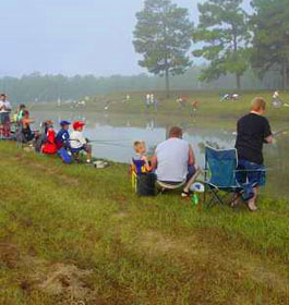
Charlie Elliott Wildlife Center-Marben PFA (Jasper & Newton Counties) - 770-784-3059
Fish Species: Largemouth bass, bluegill, redear sunfish, channel catfish, crappie.
Water: 22 ponds totalling 295 acres. Ponds range in size from 1 to 95 acres.
Facilities: Kids only ponds, concrete boat ramps (6 lakes), boat docks, restrooms, fishing piers, picnic areas, primitive camping, some fishing areas accessible to persons with disabilities. Charlie Elliott Wildlife Center also has a network of hiking trails available to visitors. Some of these trails have been impacted by recent facility construction activities at CEWC. Scroll down to see map link towards the bottom of this page. Note: Sign in at information board and check for lakes that are open for fishing when you visit. Click here for additional information about fishing at this PFA.
Directions from Mansfield: South on Georgia Highway 11 for 2.7 miles; left on Marben Farms Rd. (Co. Rd. 229), follow signs. Charlie Elliott Wildlife Center Map |
Dodge County PFA - 478-374-6765 or 229-426-5272
Fish Species: Largemouth bass, bluegill, redear sunfish, channel catfish.
Water: 104 acre lake.
Facilities: concrete boat ramps , fishing pier, restrooms, picnic tables, nature trail, some facilities accessible to persons with disabilities.
Directions from Eastman: S on US Hwy 23/341 for 3 miles; left on County Road 49 for .6 miles
Dodge County Public Fishing Area Largemouth Bass Tagging Study
Largemouth bass have been tagged and released back into the Dodge County PFA Lake. Information gained from this study will help biologists better manage the bass population in this lake. Rewards will be given to individuals catching and releasing or keeping tagged bass. Anglers must fill out envelope available at fish cleaning station. |
Evans County PFA - 912-739-1139 or 912-685-6424
Fish Species: Largemouth bass, bluegill, redear sunfish, channel catfish, crappie and brown bullhead.
Water: three ponds encompassing 122 acres (8, 30, & 84 acres).
PFA Facilities: concrete boat ramps, fishing piers, restrooms, picnic tables, primitive camping, some facilities accessible to persons with disabilities.
Directions from Claxton: East on US Highway 280 for 8.5 miles; right on Old Reidsville-Savannah Road for 1 mile; left on Old Sunbury Road (dirt), PFA 0.3 miles on right marked by Wildlife Resources sign. |
Flat Creek PFA (Houston County) - 478-825-6151
Fish Species: Largemouth bass, bluegill, redear sunfish, channel catfish.
Water: 108-acre lake. Special Note: This lake is named in honor of former DNR Commissioner Lonice C. Barrett.
PFA Facilities: Concrete boat ramp , restrooms, picnic tables, fish cleaning station, some facilities accessible to persons with disabilities.
Directions from Perry: At intersection of I-75 and State Route 127/US 41 (exit 135) in Perry, go west on SR 127/US 41 about 0.1 miles; turn left (south) on US 41 and proceed approximately 3 miles and Flat Creek PFA will be on the left at a large white farm house (look for PFA sign). |
Hugh M. Gillis PFA (Laurens County) - 478-296-6192 or 912-685-6424
Fish Species: Largemouth bass, bluegill, redear sunfish, channel catfish, crappie.
Water: 109 acre lake.
PFA Facilities: concrete boat ramp, fishing pier, restrooms, picnic tables, some facilties accessible to persons with disabilities.
Directions from East Dublin: East on US Hwy 80 for 10 miles; left on Keens Crossing Road for 1.4 miles; PFA entrance on right.
Directions from Adrian: West on US Hwy 80 for 7.4 miles; right on Keens Crossing Road for 1.4 miles; PFA entrance on right. |
McDuffie PFA (McDuffie County) - 706-595-1684
Fish Species: Largemouth bass, bluegill, redear sunfish, channel catfish.
Water: McDuffie offers anglers 7 ponds, varying from 5 to 37 acres. Note: Pond 3E will be open the 1st through the 7th of each month only.
PFA Facilities: concrete boat ramps, restrooms, picnic tables, tent and RV camping in designated areas.
Directions from Thomson: South on Highway 17 to US Highway 278; left (east) for 5.6 miles; right on Ellington Airline Road for 2.8 miles; right on Fish Hatchery Road for 0.8 miles. |
Ocmulgee PFA (Bleckly/Pulaski Counties) - 478-783-2557 (PFA) or 478-825-6151 (Fort Valley Fisheries Office)
Fish Species: Largemouth bass, crappie, bluegill, redear sunfish, channel catfish
Note: No largemouth bass harvest will be allowed initially, statewide limits will apply to other species.
Water: 106-acre lake and one special event pond
PFA Facilities: concrete boat ramps, fishing piers, restrooms, picnic tables, some facilities are accessible to persons with disabilities
Directions from Hawkinsville: Take Hwy. 341 towards Eastman then turn left on Hwy. 26 towards Cochran. Travel approximately 0.25 miles, then turn left on Upper River Road, go about 6 miles and make a left onto Allison's Landing Road, then make a right into the PFA at the sign. - Ocmulgee WMA Map |
Paradise PFA (Berrien County) - 912-285-6094
Fish Species: Largemouth bass, bluegill, redear sunfish, channel catfish, crappie, brown bullhead. Water: 68 lakes encompassing 525 acres of water.
PFA Facilities: Restrooms, picnic area, concrete boat ramps, primitive camping, fishing pier, boat dock, some facilities accessible to persons with disabilities.
Waterfowl hunting opportunities available at this PFA. Find more infromation here.
Directions from Tifton: East on US Highway 82 for 8 miles to Brookfield. Turn right onto Whitley Road and travel approximately 100 yards; take the first left onto Brookfield-Nashville Road and travel 1.5 miles. Entrance to area is on the left. |
Rocky Mountain Recreation & Public Fishing Area (Floyd County) - 706-802-5087
Fish Species: Largemouth bass, bluegill, redear sunfish, channel catfish, crappie, hybrid striped-white bass.
Water: Two lakes (202 & 357 acres).
Antioch Lake and swimming beach
Heath Lake (open the 1st through the 10th of each month)
Note: New Heath Lake regulations - Lake is now open the 1st - 10th of each month and there is now a slot limit on largemouth bass. All largemouth bass 14" - 20" must be released immediately. There is still a creel limit of 5 fish, only one of which can be over 20".
PFA Facilities: concrete boat ramps, fishing jetties, restrooms, picnic shelters, scenic overlooks, hiking trails, tent & RV camping (seasonal), group primitive camping and RV camping site near Antioch Lake (reservation only), group picnic area (reservation only), some facilities accessible to persons with disabilities.
Directions from Rome: North on US Highway 27 for 10.4 miles, left on Sike Storey Road 0.4 miles, left on Big Texas Valley Road 5.4 miles to entrance. - Rocky Mountain PFA Map |
|
|
|
Check These Out:
GA Public Fishing Areas
Fishing Trip Check List


GA Wildlife Areas:
Camping Hiking
Water Sports
Bird Watching
Public Fishing Areas (PFA)
Horseback Riding
Fish Hatcheries
Archery & Firearms Ranges
Range Rules
License & Regulations:
PFA Hunting

|