


 |
|
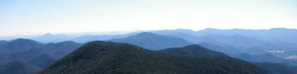
| Whether you are hunting, camping, bird watching or hiking, fishing, horseback riding, or just a person who enjoys the outdoors, Georgia's WRDs are for you! See over 100 WMAs listed below that are located in 7 Regions. |
| Check out the statewide WMA map here. |
Click on the link to the WMA region below you are interested in visiting.
Region 1 Region 2 Region 3 Region 4 Region 5 Region 6 Region 7 |
Region 1 - Contact Information Wildlife Game Management - 706-295-6041
Non-Game Wildlife & Natural Heritage - 770-918-6411 Law Enforcement - 706-624-1367 |
| Allatoona WMA - Things To Do: 9300 acres. Hunting, Camping, Fishing, Hiking, Bird Watching, Field Trail Access, Boat Ramp and Picnicking. Wildlife: Deer and Bear, Turkey, Small Game, Dove, Raccoon, Opossum, Fox, Bobcat, Raccoon, Opossum, Feral Hogs. Located in Bartow County. Note: During Ladies-Only hunts, men are restricted to campgrounds. No firearms allowed in US Corps of Engineers developed campsites. Horse and bicycle trails and areas are closed all day during deer firearms season and before 10:00 a.m. during deer archery and turkey season. No ATV may be used at any time. Directions From Cartersville: Take Hwy. 20 east from I-75, 5.5 miles to check station. Allatoona WMA Map |
| Arrowhead PFA - Things To Do: 377 acres. Hunting, Interpretive Trail, Fishing, Hiking, Bird Watching - Note: Hunters may apply by letter to DNR, Arrowhead Game Management Section, 2592 Floyd Springs Road, N.E. Armuchee, GA 30105. Shooting hours until 12 noon. Wildlife: Waterfowl. Located in Floyd County. Directions From Rome: Take US Hwy. 27 north 9 miles to GA Hwy. 156; turn right (east) and go 2.3 miles to Floyd Springs Rd; turn left and go 2 miles to area. Arrowhead WMA Map |
| Berry College WMA - Things To Do: 20,500 acres. Hunting, Field Trail Access, Hiking and Bird Watching. Note: There is no open season for the taking of any wildlife on Berry College Refuge. No firearms or bows and arrows are allowed on refuge. Hunters may not use the main campus for gaining access. Horses and bicycle trails and areas are closed all day during deer firearms season and before 10:00 a.m. during deer archery and turkey season. No ATV may be used at any time. Wildlife: Deer, Turkey, Small Game, Fox, Bobcat, Raccoon, Opossum and Dove. Located in Floyd County. Directions From Rome: Take US 27 north to jct. of Old Summerville Rd.; turn left on Old Summerville Rd. and go 1.5 miles to jct. with CCC Rd. at check station.
Berry College WMA Map |
| Cohutta WMA - Things To Do: 95,200 acres. Hunting, Camping, Fishing, Hiking, Bird Watching, Firearm Range, Picnicking, Observation Tower, Horseback Riding. Wildlife: Deer and Bear, Small Game, Fox, Bobcat, Raccoon, Opossum and Feral Hogs. Located in Murray, Fannin and Gilmer counties. Directions From Ellijay: Take Hwy. 52 west 9.2 miles; turn right at Conasauga Lake sign; go 3.5 miles; turn right on USFS Road #68, go 2.0 miles to check station. From Chatsworth: Take US Hwy. 411 North to Eton; turn right at traffic light and follow Holly Creek Rd. 11.6 miles to check station. Cohutta WMA Map |
| Coosawattee WMA - Things To Do: 10,500 acres. Hunting, Camping, Fishing, Hiking, Bird Watching, Boat Ramps, Canoe Access and Picnicking. Wildlife: Deer and Bear, Small Game, Raccoon, Opossum, Fox, Bobcat, Waterfowl and Feral Hogs. Located in Gilmer and Murray counties. Directions From Chatsworth: Go south 5.3 miles on US 411; go right 0.1 mile on Smyrna-Ramhurst Rd.; go left on Ballground Rd. 4.7 miles to sign-in station on right. Coosawatee WMA Map - Coosawattee Carters Lake Archery Map |
|
| Crockford-Pigeon Mountain WMA - Things To Do: 16,400 acres. Hunting, Camping, Fishing, Hiking, Bird Watching, Field Trial Access, Picnicking, Horseback Riding. Note: Horse and bicycle trails and areas are closed all day during firearms seasons and before 10 a.m. during archery and turkey season. Wildlife: Deer, Turkey, Raccoon, Opossum, Fox, Bobcat, Dove, Feral Hogs, Waterfowl. Located in Walker county. Directions From Lafayette: Take Hwy. 193 west 2.7 miles to Chamberlain Rd.; turn left and go 3 miles to Rocky Lane Rd.; turn right and go 0.3 mile to check station. Crockford-Pigeon Mountain WMA Map |
| J. L. Lester WMA - Things To Do: 500 acres. Hunting, Camping, Hiking, Bird Watching, Field Trail Access, Picnicking. Note: Mail Adult/Child deer (by Sept. 10) hunt application letters to: Wildlife Resources Division, Game Management Section, 2592 Floyd Springs Rd. NE, Armuchee, GA 30105. Wildlife: Deer, Turkey, Small Game, Raccoon, Opossum, Dove, Waterfowl. Located in Polk and Harrison counties. Directions From Cedartown: South of Cedartown at jct. of Bus. U.S. 27 and U.S. 27, go north 1/4 mile on U.S. 27 to Cason Rd.; turn right and go 4.3 miles to check station. J. L. Lester WMA Map |
John's Mountain WMA - Things To Do: 24,000 acres. Hunting, Camping, Fishing, Firearms Shooting Range, Field Trail Access, Hiking, Bird Watching, Picnicking and Observation Tower and Horseback Riding. Directions From Calhoun: Take Hwy. 136C north 6 miles to Sugar Valley; turn left and go 6 miles to Lake Marvin; check station is at The Pocket.
Located in Gordon and Murray Counties. John's Mountain WMA Map |
| McGraw Ford WMA - Things To Do: 2400 acres. Hunting, Field Trail Access, Hiking and Bird Watching. Note: No horse or bicycle use before 10 am. during deer archery and turkey season. Wildlife: Deer, Turkey, Small Game, Fox, Bobcat, Raccoon, Opossum, Dove, Feral Hogs. Located in Pickens and Cherokee counties. Directions From Ballground: From jct. of Bus. Hwy 5 and Hwy 372 travel 2.1 miles east to Conns Creek Rd.; turn left, go 0.9 miles to sign-in on right. McGraw Ford WMA Map |
| Otting WMA - Things To Do: 700 acres. Hunting, Camping, Fishing, Field Trail Access, Hiking and Bird Watching. Wildlife: Deer, Turkey, Small Game, Raccoon, Opossum, Fox, Bobcat, Dove. Located in Chattooga county. Directions From Cloudland: Take Hwy. 157 north 2.1 miles. The property is north of Hwy. 157. Otting WMA Map |
|
| Paulding Forest WMA - Things To Do: 26,200 acres. Hunting, Camping, Fishing, Field Trail Access, Hiking and Bird Watching. Note: No ATVs may be used at any time. Wildlife: Deer, Turkey, Small Game, Raccoon, Opossum, Fox, Bobcat, Dove, Feral Hogs. Located in Polk, Paulding and Haralson counties. Directions From Dallas: At jct. of US 278 and Hwy. 61, take US 278 west 7 miles to check station. Paulding Forest WMA Map - Paulding Forest North - Paulding Forest South |
| Pine Log WMA - Things To Do: 14900 acres. Hunting, Camping, Fishing, Field Trail Access, Hiking and Bird Watching. Note: Horse and bicycle trails and areas are closed all day during deer firearms season and before 10 a.m. during deer archery and turkey season. No ATV’s may be used at any time. Wildlife: Deer and Bear, Small Game, Fox, Bobcat, Raccoon, Opossum and Feral Hogs. Located in Cherokee county. Directions From Cartersville: Take US 411 north to White; turn right on Stamp Creek Rd.; go 3.6 miles; check station on left. Pine Log Mountain WMA Map |
| Rich Mountain WMA - Things To Do: 22,000 acres. Hunting, Camping, Fishing, Archery Range, Field Trail Access, Canoe Access, Hiking, Bird Watching, Picnicking and Horseback Riding. Note: On Cartecay Tract, horse and bicycle trails and areas are closed before 10 a.m. during deer archery and turkey season. Located in Gilmer County. Directions From Ellijay: Take Hwy. 515 north 7 miles to Co. Road 151; turn right, go 4 miles to Stanley Creek check station. Rich Mountain WMA Map |
| Sheffield WMA - Things To Do: 3300 acres. Hunting, Camping, Field Trail Access, Hiking and Bird Watching. Wildlife: Deer, Turkey, Small Game, Raccoon, Opossum, Fox, Bobcat, Feral Hogs. Located in Bartow county. Directions From Cartersville: Take Hwy. 61 south 13.2 miles to Braswell Mountain Rd.; turn right; go 2.4 miles to Lee Rd.; turn right and proceed 1.2 miles to area. From Dallas: Take Hwy. 61 north 6.2 miles to Braswell Mountain Rd.; turn left; go 2.4 miles to Lee Rd.; turn right and proceed 1.2 miles to area. Sheffield WMA Map |
| Zahnd Natural Area - Things To Do: Hiking and Hunting. Wildlife: Deer, Turkey, Small Game, Raccoon, Opossum, Fox, Bobcat, Feral Hogs Located in Walker county. Directions From Cloudland: Take Hwy. 157 north 12.7 miles; property is west of Hwy. 157. Zahnd Natural Area Map
|
|
Region 2 - Contact Information Wildlife Game Management - 770-535-5700
Non-Game Wildlife & Natural Heritage - 770-918-6411 Law Enforcement - 770-535-5499 |
| Blue Ridge WMA - Things To Do: 38,900 acres. Hunting, Camping, Interpretive Trail, Fishing, Hiking, Bird Watching, Picnicking, Horseback Riding. Blue Ridge Wildlife Management Area.
Note: Horse and bicycle trails and areas are closed all day during primitive weapons and firearms deer seasons and before 10 a.m. during archery and turkey seasons. No hunting on Camp Merrill. Wildlife: Deer and Bear, Turkey, Small Game, Raccoon, Opossum, Fox, Bobcat, Raccoon, Opossum, Waterfowl, Feral Hogs. Located in Lumpkin and Union counties. Directions From Dahlonega: To the Jones Creek check station: Travel 9 miles west on Hwy. 52 to Nimblewill Rd.; turn right and go 2.4 miles; turn right on USFS Rd. #28 and go 2.4 miles to USFS Road #77; take left fork to check station. To the Rock Creek check station: Take GA 60 north for 28 miles to jct. with USFS Road #69; turn left and go 1 mile to the check station. Blue Ridge WMA Map |
| Broad River Natural Area - Things To Do: 440 acres. Hunting, Fishing, Hiking, and Bird Watching. Wildlife: Deer, Turkey, Small Game, Fox, Bobcat, Raccoon, Opossum. Located in Madison county. Directions From Danielsville: Go north on US 29 for 2 miles; turn right on Hwy. 281; go 4 miles, cross Broad River; go .3 mile, and area is on right. Broad River Natural Area Map
|
| Chattahoochee WMA- Things To Do: 2,5000 acres. Hunting, Camping, Fishing, Hiking, Bird Watching and Picnicking. Wildlife: Deer and Bear, Turkey, Small Game, Raccoon, Opossum, Fox, Bobcat, Raccoon, Opossum, Feral Hogs. Located in White county. Directions From Helen: Take Hwy. 75 north to Robertstown, turn left on Alt. Hwy. 75; cross bridge; turn right, go 2.8 miles to check station. Chattahoochee WMA Map |
| Chestatee WMA - Things To Do: 25,000 acres. Hunting, Camping, Fishing, Hiking, Bird Watching and Picnicking. Wildlife: Deer and Bear, Turkey, Small Game, Raccoon, Opossum, Fox, Bobcat, Raccoon, Opossum-, Feral Hogs Located in Union and Lumpkin counties. Directions From Cleveland: Take US 129 north 10.5 miles to Turner’s Corner; turn left on US 19; go 0.5 mile; turn right on Dick’s Creek Rd.; go 1 mile to check station driveway on left. Chestatee WMA Map |
|
| Coopers Creek WMA - Things To Do: 30,000 acres. Hunting, Camping, Fishing, Hiking, Bird Watching and Picnicking. Wildlife: Deer and Bear, Turkey, Small Game, Raccoon, Opossum, Fox, Bobcat, Raccoon, Opossum, Feral Hogs Located in Union county. Directions From Dahlonega: Take GA Hwy. 60 north 26 miles to jct. of Coopers Creek Rd; turn right and go 0.5 mile to jct. of USFS Road #236; turn left and go 4 miles to jct. of USFS Road #4; turn right and go 0.5 mile to check station. From Blairsville: Take Old Blue Ridge Hwy west 5 miles to Mulkey Gap Rd.; turn left and travel 8.5 miles to check station. Coopers Creek WMA Map |
Dawson Forest WMA- Things To Do: 25,000 acres. Hunting, Camping, Interpretive Trail, Fishing, Hiking, Bird Watching and Picnicking. Note: There are 4 different WMA maps for Dawson Forest, Amicalola Tract, Atlanta Tract, Wildcat Creek Tract. Please see the WMA maps page for all the maps. Only bucks with 4 or more points (one inch long or longer) on either side are legal. Horse and bicycle trails and areas are closed all day during firearms deer seasons and before 10 a.m. during archery and turkey seasons. Roads on the City of Atlanta tract are closed to vehicles daily from 10 PM - 6 AM except for individuals legally camping, hunting, or fishing on the area. Wildlife: Deer and Bear, Turkey, Small Game, Raccoon, Opossum, Fox, Bobcat, Raccoon, Opossum, Dove, Waterfowl, Feral Hogs. Located in Dawson and Forsyth counties. Directions From Dawsonville: Take GA Hwy. 53 west 6 miles; turn right onto driveway at kiosk; check station is at top of hill. Dawson Forest WMA Map - Dawson Forest WMA Amicalola Tract - Dawson Forest WMA-Atlanta Tract Map Dawson Forest WMA-Wildcat Creek Tract Map |
| Dukes Creek - Smithgall Woods EEC - Things To Do: 4500 acres. Hunting, Fishing, and Field Trail Access, Interpretive Trail, Bird Watching. Note: Only bucks with 4 or more points (one inch or longer) on either side are legal. For Adult/Child or Honorary License Holders hunt, hunters must apply by letter to WRD-Game Management, 2150 Dawsonville Hwy., Gainesville, GA 30501 by early September. Call for date. Wildlife: Deer, Small Game, Fox, Bobcat, Raccoon, Opossum, Feral Hogs. Located in White county. Directions From Helen: Take Hwy. 75 north to Robertstown, turn left on Alt. GA 75; go 2.2 miles, turn left into Smithgall Woods at Stone Pillars; follow signs to check station. Dukes Creek - Smithgall Woods State Park Map |
| Hart County WMA- Things To Do: 1000 acres. Hunting, Camping, Bird Watching and Picnicking. Wildlife: Deer, Turkey, Small Game, Fox, Bobcat, Raccoon, Opossum, Dove. Located in Hart county. Directions From Hartwell: Take Hwy. 77 south 1.5 miles; turn left onto Liberty Rd.; go 4 miles to the end of the pavement at Cedar Creek; the area lies to the south. Hart County WMA Map |
| Lake Russell WMA - Things To Do: 17,300 acres. Hunting, Camping, Fishing, Hiking, Bird Watching, Picnicking and Horseback Riding. Note: Apply by letter for Adult/Child hunt by Sept. 10 to WRD-Game Management, 2150 Dawsonville Hwy., Gainesville, GA 30501. On Ladies Only hunts, men are restricted to campground. Wildlife: Deer and Bear, Turkey, Small Game, Raccoon, Opossum, Fox, Bobcat, Raccoon, Opossum, Feral Hogs. Located in Habersham, White and Banks counties. Directions From Gainesville: Take Hwy. 365 north about 33 miles to GA 13; turn right; go 2.2 miles and turn left on Ayersville Rd. by the Milliken plant; go 0.9 mile and turn left on Check Station Rd.; go 0.5 mile to check station on left. Lake Russell WMA Map |
| Lula Bridge Tract WMA - Amenities: 513 Acres. Wildlife: Waterfowl-Statewide Season. Located in Hall County. Directions from Gainesville: Take US Hwy. 365 north 7 miles from Exit 24; turn left on GA Hwy. 52; go 3 miles; cross Chattahoochee River; turn right into boat ramp parking lot. Lula Bridge Tract WMA Map |
| Swallow Creek WMA- Things To Do: 19,000 acres. Hunting, Camping, Fishing, Hiking, Bird Watching and Picnicking. Wildlife: Deer and Bear, Turkey, Small Game, Raccoon, Opossum, Fox, Bobcat, Raccoon, Opossum, Feral Hogs Located in Towns and Union counties. Directions From Cleveland: Take Hwy. 75 north 20 miles to GA 180; continue on Hwy 75 for 1 mile and turn left at check station sign. Swallow Creek WMA Map |
| Warwoman WMA - Things To Do: 15,800 acres. Hunting, Camping, Fishing, Hiking, Bird Watching and Picnicking. Wildlife: Deer and Bear, Turkey, Small Game, Raccoon, Opossum, Fox, Bobcat, Raccoon, Opossum, Feral Hogs Located in Rabun county. Directions From Clayton: Take US 441 north; turn right on Warwoman Rd.; go 3.5 miles to Finney Creek Rd.; turn left and go 0.2 miles to check station. Warwoman WMA Map |
| Wilson Shoals WMA- Things To Do: 2800 acres. Hunting, Camping, Firearms Shooting Range, Bird Watching and Picnicking. Located in Banks County. Directions From Gainesville: Take Hwy. 365 north 11 miles; turn right on Mud Creed Rd; go 1 mile, turn left; go 0.1 mile, turn right on Yonah Rd.; go 2.1 miles, area on left. Wilson Shoals WMA Map |
|
Region 3 - Contact Information
Wildlife Game Management - 706-595-4222
Non-Game Wildlife & Natural Heritage - 770-918-6411 Law Enforcement - 706-595-4211 |
| Alexander WMA - Note: Special Regulations: No camping on area. Wildlife: Deer, Turkey, Fox, Bobcat, Raccoon, Opossum, Feral Hogs. Located in Burke county. Directions From Waynesboro: Take GA Hwy. 24 east 6 miles; turn right on Harrison Rd.; go 1.5 miles to sign-in board. Alexander WMA Map |
| Broad River WMA- Things To Do: 1500 acres. Hunting, Fishing, Canoe Access, Bird Watching. Note: No camping on area. Corps of Engineers campground may be used. Wildlife: Deer, Turkey, Raccoon, Opossum, Fox, Bobcat, Dove, Feral Hogs, Located in Ebert county. Directions From Elberton: Take Hwy. 72 east 11 miles turn on Hwy. 79; go 7.3 miles to River Rd., turn right. Go 0.75 miles to sign-in board on left. Broad River WMA Map |
| Clarks Hill WMA - Things To Do: 12,700 acres. Hunting, Archery Range, Camping, Boat Ramp, Canoe Access, Fishing and Bird Watching. Note: Area west of US Hwy. 78/GA Hwy. 17 is open for hunting during statewide seasons only. Wildlife: Ferel Hogs. Located in McDuffie and Wilkes Counties. Directions From Thomson: Take US 78 north 10 miles; turn right on Smith Mill Rd. at WMA sign; go 2.5 miles to check station. Clarks Hill WMA Map |
| Di-Lane WMA - Things To Do: 8100 acres. Hunting, Camping, Interpretive Trail, Fishing, Hiking, Bird Watching, Field Trail Access, Horseback Riding. Note: Only bucks with 4 or more points (one inch long or longer) on one side are legal. Bird dog training; Oct. 25-27. For bird dog field trials apply by letter to: Ray Jeffers, GA Field Trial Association, P.O. Box 87, Cedartown, GA 30125. Wildlife: Deer, Turkey, Quail, Small Game, Raccoon, Opossum, Feral Hogs. Located in Burke county. Directions From Wayneboro: Take Hwy 25 South to 4th Street. Turn right on 4th|Street/Herndon Rd. and go 10 miles. Follow signs to check station. Di-Lane WMA Map |
| Elbert County WMA - Things To Do: 2500 acres. Hunting, Boat Ramp, Fishing and Bird Watching. Wildlife: Deer, Turkey, Small Game, Raccoon, Opossum, Fox, Bobcat, Feral Hogs. Located in Elbert county. Directions From Elberton: Take Hwy. 72 east 5 miles; turn north on Pearl Mill Rd.; go 1.5 miles to area. Elbert County Beverly Tract Map - Elbert County Elbert Tract Map - Elbert County Heardmont Tract Map - Elbert County Pickens Tract Map - Elbert County Vaughter Tract Map |
| Fishing Creek WMA - Things To Do: 2900 acres. Hunting, Camping, Fishing, Hiking and Bird Watching. Note: Saturday only during State Season on waterfowl impoundments. Call for info. Wildlife: Deer, Turkey, Small Game, Raccoon, Opossum, Fox, Bobcat, Waterfowl. Located in Wilkes county. Directions From Washington: Take Hwy. 44 East 12.8 miles to O’hara-Standard Rd.; turn right; at end turn left on Jones Chapel and continue to area. To Waterfowl Area From Lincolnton: Take Hwy. 79 eight miles to Midway Church Rd. and turn left. Go 1.5 miles to sign on right. Fishing Creek WMA Map |
| Germany Creek WMA - Things To Do: 1200 acres. Hunting, Fishing, Bird Watching - Note: Boat access only. No camping on area; Corps of Engineers campgrounds may be used. Unauthorized motor vehicles prohibited on area. Wildlife: Deer, Turkey, Small Game, Fox, Bobcat, Feral Hogs. Located in McDuffie and Columbia counties. Directions From Thomson: Access only by boat (Nearest boat ramp is Raysville Bridge on GA Hwy. 43 approximately 12 miles north of Thomson). The area is to the east of bridge access. Germany Creek WMA Map |
| Keg Creek WMA - Things To Do: 800 acres. Hunting, Fishing, Hiking, Bird Watching. Note: No Camping on area. Wildlife: Deer, Turkey, Small Game, Raccoon, Opossum, Feral Hogs. Located in Lincoln and Columbia counties. Directions From Pollards Corner: Take Hwy. 47 west 2 miles. Area is on left side of Hwy. Keg Creek WMA Map |
| Oconee WMA - Things To Do: 4100 acres. Hunting, Camping, Interpretive Trail, Fishing, Hiking, Bird Watching, Observation Tower. Note: No fishing or hunting (other than ducks and geese, and archery deer hunting during statewide archery and Primitive weapons season) on waterfowl area west of Oconee River. Waterfowl hunting is prohibited on the Oconee River between Wallace Dam and GA Hwy. 16. Mail Adult/Child Waterfowl Application letter to: Wildlife Resources Division, 142 Bob Kirk Rd. NW, Thomson, GA 30824. (see Adult/Child Hunts on page 14). Located in Green County. Directions From Eatonton: Take Hwy. 16 east 14.7 miles to the Oconee River; proceed 1.3 miles to Georgia Power Company Rd.; turn left and follow signs 3 miles to check station. The waterfowl area check-in is on the west side of the Oconee River next to Hwy. 16. Ocone WMA Map |
| Phinizy Swamp WMA - Things To Do: 1500 acres. Hunting, Fishing, Hiking and Bird Watching. Wildlife: Deer, Turkey, Fox, Bobcat, Raccoon, Opossum, Waterfowl, Feral Hogs. Located in Richmond county. Directions From Augusta: From I-520 exit south on Hwy. 56 spur (Doug Barnard Pkwy.); go 0.5 mile to WMA entrance sign adjacent to Augusta Wastewater Treatment Facility; or from I-520, exit north on Hwy. 56 spur (Doug Barnard Pkwy.); go 1.6 milesand turn right on Gravel Pit Road. WMA is at end of road. Phinizy Swamp WMA Map |
Redlands WMA- Things To Do: 37,500 acres. Hunting, Camping, Archery Range and Firearms Shooting Range, Observation Tower, Boat Ramp, Canoe Access, Fishing, Hiking, Bird Watching, Picnicking and Horseback Riding. Note: No hunting on Dyers Pasture MARSH pond.
Located in Green County. Directions From Greensboro: Take GA Hwy. 15 north 9 miles; check station on left. Redlands WMA Map |
| Soap Creek WMA - Things To Do: 1000 acres. Hunting, Fishing and Bird Watching. Wildlife: Deer, Turkey, Raccoon, Opossum, Fox, Bobcat, Feral Hogs. Located in Lincoln county. Directions From Lincolnton: Take Hwy. 79 north 4 miles. Area is right of highway. Soap Creek WMA Map |
| Tuckahoe Wildlife Management Area - Activity: Hunting. Wildlife: Deer, Turkey, Small Game, Raccoon, Opossum, Fox, Bobcat, Raccoon, Opossum, Dove, Feral Hogs. Located in Screven county. Directions From Sylvania: Take E. Ogeechee 2.2 miles to jct. of Buck Creek and Brannen’s Bridge Rd., take Brannen’s Bridge Rd. 3.4 miles to jct. of GA Hwy. 24, continue on Brannen’s Bridge Rd. 5.2 miles to check station on left. Tuckahoe WMA Map |
| Walton Pulbic Dove Field and Hatchery - Activities: Hunting and Bird Watching. Note: Bird dog training allowed Aug. 15-Mar. 15. Wildlife: Deer and Dove. Located in Walton and Morgan coounties. Directions From I-20: At exit 101, take Hwy 278 north 1.7 miles. Area is on left across from Wildlife Resources Headquarters. Walton Public Dove Field Map |
| Yuchi WMA - Things To Do: 7800 acres. Hunting, Camping, Firearms Shooting Range, Boat Ramp, Canoe Access, Fishing, Hiking, Bird Watching, Horseback Riding. Note: Firearms Range. Sign-In at Check Station on Ebenezer Church Rd.. Camping in designated sites only. Located in Burke county. Directions From Waynesboro: Take Hwy. 80 east 8 miles to Shell Bluff Community; turn right on Hwy. 23; travel 7 miles south; turn left on Ebenezer Church Rd.; go 1 mile to Check Station on right. Yuchi WMA Map |
Region 4 - Contact Information Wildlife Game Management - 912-825-6354
Non-Game Wildlife & Natural Heritage - 912-994-1438 Law Enforcement - 912-751-6415 |
| B. F. Grant WMA - Things To Do: 11,900 acres. Hunting, Boat Ramp, Canoe Access, Fishing, Firearms Shooting Range, Field Trail Access, Hiking, Picnicking, Bird Watching and Observation Tower. Note: Only bucks with 15" outside spread or 16" main beams are legal. No hunting on pastures.
Wildlife: Deer, Turkey, Raccoon, Opossum, Fox, Bobcat Fox, Bobcat, Waterfowl, Dove, Feral Hogs. Located in Putnam County. Directions From Eatonton: Take Hwy. 16 west 0.7 miles; turn right on Hwy 441 Bypass; go 1.5 miles to Godfrey Rd.; turn left and go 6 miles to check-in station. B. F. Grant WMA Map |
| Big Lazer Creek WMA
- Things To Do: 5900 acres. Hunting, Camping, Boat Ramp, Fishing, Hiking, Bird Watching, Field Trail Access. Note: WMA stamp is required to fish. Only bucks with at least 4 points (one inch long or longer) on either side are legal. Wildlife: Deer, Turkey, Small Game, Raccoon, Opossum. Located in Talbot County. Directions From Talbotton: Take US 80 east 4 miles; turn left on Po Biddy Rd. go 6.5 miles; turn left on Bunkum Rd. and go 1.2 miles to check station. Big Lazer Creek WMA Map |
| Blanton Creek WMA - Things To Do: 4800 acres. Hunting, Fishing, Hiking, Bird Watching, Field Trail Access, Interpretive Trail and Picnicking. Note: Only bucks with at least 4 points (one inch long or longer) on either side are legal. Call to see when Blanton Creek Parkground Ga. Power) is open to hunters for camping. Wildlife: Deer, Turkey, Raccoon, Opossum, Dove. Located in Harris County. Directions From West Point: Take Hwy. 103 south 10 miles to mile marker 6, turn right to check station. Blanton Creek WMA Map |
| Cedar Creek WMA - Things To Do: 29,000 acres. Hunting, Camping, Fishing, Firearms Shooting Range, Hiking and Bird Watching. Wildlife: Deer, Small Game, Raccoon and Opossum. Located in Baldwin, Jones and Jasper Counties. Directions From Monticello: Take Hwy. 16 east 3/4 mile; take right fork on Hwy. 212; go 12 miles to check station sign; follow arrow 0.5 mile to check station. Cedar Creek WMA Map - Cedar Creek North WMA Map - Cedar Creek South WMA Map - Cedar Creek Central WMA Map - Cedar Creek Little River Area WMA Map |
Clybel WMA (also known as Charlie Elliott) - 770-784-3059 or 912-825-6354
Things To Do: 6400 acres. Hunting, Camping, Fishing, Firearms Shooting Range, Boat Ramp, Canoe Access, Interpretive Trail, Hiking, Bird Watching, Field Trail Access, Picnicking, Horseback Riding. Note: Apply for Adult/Child turkey hunts by letter to Wildlife Resources Division, 1014 Martin Luther King Blvd., Ft. Valley, Georgia 31030 between Feb. 1-28. (see Adult/Child Hunts). Located in Jasper County. Directions From Mansfield: Take Hwy. 11 south 2.7 miles; turn left at WMA Sign; follow signs 2 miles to check station. Clybel WMA Map |
| Joe Kurz WMA - Things To Do: 3700 acres. Hunting, Field Trail Access, Boat Ramp, Canoe Access, Fishing, Hiking, Bird Watching. Note: Only bucks with 15" outside spread or 16" main beams are legal. Wildlife: Deer, Turkey, Small Game, Raccoon, Opossum, Dove and Feral Hogs. Located in Meriwhether County. Directions From Woodbury: Take Hwy 85 north for 7.5 miles to Gay; turn right at red light; check station is 2.7 miles on left. Joe Kurz WMA Map |
| Oaky Woods WMA - Things To Do: 17,800 acres. Hunting, Fishing, Hiking, Bird Watching, Field Trail Access. Wildlife: Deer, Turkey, Small Game, Raccoon, Opossum, Fox, Bobcat, Dove, Feral Hogs, Located in Houston County. Directions From Perry: Take Hwy. 127 east 8 miles to Hwy 247; turn right; go 1 mile; turn left on Oaky Woods Rd. at fork go 1.7 miles to check station. |
| Ocmulgee WMA - Things To Do: 32,000 acres. Hunting, Fishing, Firearms Shooting Range, Hiking, Bird Watching, Field Trail Access. Located in Bleckley County. Directions From Cochran: Take US 23 north, turn left on Red Dog Farm Road; go 4 miles to Magnolia Road. Turn right and follow signs to check station. Ocmulgee WMA - All Tracts - Map - Ocmulgee WMA Tract 1 - Ocmulgee WMA Tracts 2, 3, 4 and 6 - Ocmulgee WMA Tract 5 - Ocmulgee WMA Gum Swamp Creek Tract |
| Rum Creek WMA - Things To Do: 6000 acres. Hunting, Interpretive Trail, Boat Ramp, Canoe Access, Fishing, Hiking, Bird Watching, Field Trail Access, Observation Tower and Picnicking. Note: WMA stamp is required to fish. No motor in excess of 25 hp may be operated on Lake Juliette. No waterfowl hunting west of Ebenezer Road except that youth area is all between Ebenezer and Juliette Roads. Apply for Adult/Child turkey hunts by letter to: Wildlife Resources Division, 1014 Martin Luther King Blvd., Fort Valley, GA 31030 between Feb. 1-28 (see Adult/Child Hunts on page 14). Dove hunters must call 478-825-6354 between Aug. 1-15 to apply for quota hunt dates. Wildlife: Deer, Turkey, Small Game, Raccoon, Opossum, Fox, Bobcat, Dove, Waterfowl, Feral Hogs. Located in Monroe County. Directions From Forsyth: Take Hwy. 18 east 7 miles to Check Station Rum Creek WMA Map |
| Sprewell Bluff WMA - Things To Do: 2800 acres. Hunting, Fishing, Hiking, Bird Watching. Note: No hunting in park day-use area. Pigeon Creek Tract closed to all vehicular access. Wildlife: Deer, Turkey, Small Game and Feral Hogs. Located in Upson County. Directions from Thomaston: Take Hwy 36 west 6 miles to Roland; turn right on Alabama Rd.; turn left and follow paved road to area. DIRECTIONS FROM MANCHESTER TO NICHOLS AND PIGEON CREEK TRACTS: Take Hwy. 190 east 3.9 miles; turn left on dirt road; go 0.1 mile to fork; turn left; go 1.8 miles to fork in road; right fork to Nichols Tract; left to Pigeon Creek Tract. Sprewell Bluff WMA Map |
| Standing Boy Creek - Things To Do: 1500 acres. Hunting, Hiking, Bird Watching. Note: Upon determination by the Commissioner that a person has violated this title or any rule or regulation promulgated pursuant to hunting or trespass on or from Standing Boy Creek Tract, the Commissioner may revoke, suspend, deny, or refuse to renew any license or permit, or both, required by this title which is held by or has been applied for by the person, for a period of up to two years following the determination of such violation. Harvested deer will not be tagged with Department tags and must be recorded on the hunters' deer harvest record. No Camping on area. Wildlife: Deer. Located in Muscogee County. Directions from Columbus: Take Hwy. 219 North from Columbus; turn left on Old River Road; go about ½ mile, entrance is on left and kiosk is just inside of gate. Standing Boy Creek Map |
| West Point WMA - Things To Do: 10,000 acres. Hunting, Firearms Shooting Range, Interpretive Trail, Fishing, Hiking, Bird Watching, Field Trail Access. Note: No gasoline outboards allowed on waterfowl ponds; only hand held lights 6 volts or less allowed; Only bucks with at least 4 points (one inch long or longer) on either side are legal. No fishing on managed waterfowl impoundments. Located in Heard and Troup Counties. Wildlife: Deer. Directions From Lagrange: Take GA Hwy. 219 north 1.5 miles past Chattahoochee River Bridge; turn right on Old Whittley Rd. Go 1.2 miles, turn right; go 0.6 miles, turn left just past bridge. Check station is on right. West Point WMA Map |
Region 5 - Contact Information Wildlife Game Management - 229-430-4254
Non-Game Wildlife & Natural Heritage - 478-994-1438 Law Enforcement - 229-430-4252 |
| Albany Nursery (Lawrence Pearce) - Things To Do: Hunting, Interpretive Trail, Bird Watching, Field Trail Access, Canoe Access, Horseback Riding. Note: Physically Disabled Persons Hunt for wheelchair hunters only. Hunters must apply by letter to the Wildlife Resources Division, 2024 Newton Rd., Albany, GA 31701 between Aug. 15 and Sept. 10 for deer hunts and between Feb. 15 and March 10 for turkey hunts. Wildlife: Deer, Turkey, Squirrel and Dove. Located in Dougherty and Calhoun Counties. Directions From Albany: Take GA Hwy. 234 W 11 miles; turn right on Tallahassee Rd.; go 1.2 miles to entrance on right. Albany Nursery WMA Map |
| Chickasawhatchee WMA - Things To Do: 19,700 acres. Hunting, Camping, Fishing, Hiking, Bird Watching and Field Trail Access. Note: Only bucks with at least 4 points (one inch long or longer) on either side are legal. Wildlife: Deer, Turkey, Small Game, Raccoon, Opossum, Fox, Bobcat, Feral Hogs. Located in Baker, Calhoun and Dougherty Counties. Directions From Albany: Take Hwy. 91 south 4 miles to jct. with Hwy. 62; turn right and go 15 miles; follow signs to check station. Chickasawhatchee WMA Map |
| Doerun Pitcherplant Bog Natural Area - Things To Do: 600 acres. Hunting, Interpretive Trail, Bird Watching. Note: Doerun Natural Area contains rare species and sensitive habitats. To protect these resources, vehicular access is limited to entrance road and parking area. No ATVs or horses are allowed on the area. Wildlife: Deer. Located in Charlton and Brantley Counties. Directions From Doerun: Take Hwy 133 S two miles; turn left at Natural Area sign. Doerun Pitcherplant Bog Natural Area Map |
| Elmodel WMA - Things To Do: 1600 acres. Hunting and Canoe Access. Wildlife: Deer, Dove, Fox, Bobcat, Raccoon, Opossum. Located in Miller and Seminole Counties. Directions From Newton: Take Hwy. 37 north 8 miles; turn left on Power Dam Rd.; area is on right. Elmodel WMA Map |
| Flint River WMA - Things To Do: 2300 acres. Hunting, Fishing, Hiking, Bird Watching, Horseback Riding. Note: Only bucks with 15" outside spread or 16" main beams are legal. Physically Diabled hunt for wheelchair hunters only. Each physically disabled hunter may bring an attendent (if needed) who may provide assistance but not hunt. Wildlife: Deer, Fox & Bobcat, Raccoon & Opossum, Small Game and Turkey. Directions From Vienna: Take Hwy. 27 to Hwy. 230, turn right; go 1 mile; veer left on River Rd. and go 6 miles to entrance sign. Flint River WMA Map |
| Hannahatchee Creek WMA - Things To Do: 5600 acres. Hunting, Camping, Firearms Shooting Range, Hiking, Bird Watching and Horseback Riding. Note: All deer harvested Nov. 2-3 must be checked at WMA check station. WMA bonus deer tags will be provided on these dates; hunters should not record a kill on the deer harvest record. Wildlife: Deer. Located in Stewart County. Directions From Richland: Take Hwy. 27 west toward Lumpkin; Go 4 miles to 1st paved road; turn right and go 3 miles; turn left and go 1 mile to 1st dirt road on right; turn right and proceed to check station. Hannahatchee Creek WMA Map |
| Lake Seminole WMA - Things To Do: 16,900 acres. Hunting, Camping, Boat Ramp, Canoe Access, Fishing, Hiking, Bird Watching and Field Trail Access - Borders Lake Seminole near Bainbridge. Note: No hunting within 300 yards of a house, dock, building, or other structure, or a developed recreation area (i.e. beach, campground, boat ramp, etc.). Wildlife: Deer, Turkey, Small Game, Raccoon, Opossum, Fox, Bobcat, Raccoon, Opossum and Feral Hogs. Located in Seminole and Decatur Counties. Directions can be obtained from the Albany Game Management Office, 2024 Newton Rd., Albany, GA 31708. Lake Seminole WMA Map - Dresser Tract - Fairchild Tract - Four Mile Creek Tract - Hales Landing Tract - Little Horseshoe Bend Tract - Ranger Station Tract - River Junction Tract - Spring Creek Tract - Ten Mile Still Tract |
| Lake Walter F. George WMA - Things To Do: 1900 acres. Hunting, Boat Ramp, Canoe Access, Fishing, Hiking and Bird Watching - Borders Lake Walter F. George, north of Fort James. Note: Waterfowl hunting permitted on portions of lake in Georgia, except within 200 yards of a public park, road, cabin, or other developed areas. Areas within Eufaula National Wildlife Refuge have separate regulations. Wildlife: Deer, Turkey, Raccoon, Opossum, Fox, Bobcat, Raccoon, Opossum and Feral Hogs. Located in Clay County. Location: This WMA consists of 8 different tracts of land that can be found at various points along the lake shore. Directions can be obtained from the Albany Game Management Office, 2024 Newton Rd., Albany, GA 31701. Cool Branch Tract Map - Patala Creek Park Tract - Sandy Branch Tract - Tobannee Creek Tract |
| Mayhaw WMA - Things To Do: 4700 acres. Hunting, Camping, Firearms Shooting Range, Hiking, Bird Watching, Horseback Riding. Note: Deer harvested Nov. 9-10 must be checked at WMA check station. WMA bonus deer tags will be provided on these dates; hunters should not record kill on their deer harvest record. No waterfowl hunting on MARSH pond on north end of Willoughby tract. Located in Miller County. Wildlife: Deer. Directions From Colquitt: Firetower Tract is 1 mile west of Colquitt on Hwy. 91. Willoughby and Oldhouse tracts: From Colquitt take US 27 North to first paved road; turn left and go 1 mile to Willoughby Tract and 2 miles to Oldhouse Tract. Check station is located near entrance to Willoughby tract. Mayhaw WMA Map |
| Montezuma Bluffs Natural Area - Things To Do: 500 acres. Hunting, Boat Ramp, Canoe Access, Fishing, Interpretive Trail, Bird Watching. Note: Only antlered bucks with 15” outside spread or 16” main beams are legal. Montezuma Bluff Natural Area contains rare species and sensitive habitats. To protect these resources, vehicular access is limited to boat landing road. No ATVs or horses allowed. Wildlife: Deer. Located in Macon County. Directions From Montezuma: Take Hwy. 149 north 1 mile to boat landing road; area lies along river bluff north and south of boat landing road. Montezuma Bluffs Natural Area Map |
| River Creek, The Rolf & Alexandra Kauka WMA - Things To Do: 2600 Acres. Camping, Hunting, Check Station, Waterfowl Impoundment, Dove Field and Pond. Located in Thomas County. River Creek WMA Map |
| Silver Lake WMA - Things To Do: 9200 Acres. Hunting, Boat Ramps and Ponds. Located in Decatur County. |
Region 6 - Contact Information Wildlife Game Management - 229-426-5267
Non-Game Wildlife & Natural Heritage - 478-994-1438 Law Enforcement - 912-685-2145 |
| Beaverdam WMA - Things To Do: 5500 acres. Hunting, Camping, Fishing, Archery Range, Firearms Shooting Range, Boat Ramp, Bird Watching and Field Trail Access. Located in Wilkinson County. Directions From Dublin: Take US 441 north 4.5 miles; turn right on Old Toomsboro Rd., go 7.5 miles to WMA sign; turn right on Oconee Church Rd., go 1.5 miles, turn left at WMA sign. Beaverdam WMA Map |
| Big Hammock WMA & Natural Area -Things To Do: 6900 acres. Hunting, Camping, Bird Watching, Boat Ramp, Canoe Access, Fishing, Firearms Shooting Range and Bird Watching. Note: No firearms deer hunting allowed in Natural Area and archery hunters may not hunt within 50 feet of the nature trail. Located in Tattnail County. Directions From Glennville: Take Hwy 144 south 12 miles to Altamaha River. Area lies on both sides of Hwy 144. Big Hammock WMA Map |
| Bullard Creek WMA - Things To Do: 13,900 acres. Hunting, Camping, Boat Ramp, Canoe Access, Fishing, Firearms Shooting Range, Archery Range, Bird Watching, Field Trail Access and Picnicking. Note: For Montgomery County Tract: Access is limited to foot or boat travel only. Antlered bucks may be harvested only if they have a minimum of 4 points on one side. Located in Jeff Davis County. Directions From Hazelhurst: Take US 221 north 7 miles; turn left at entrance sign; go to check station. Bullard Creek WMA Map - Bullard Creek East - Bullard Creek West |
| Dixon Memorial WMA
- Things To Do: 36,100 acres. Hunting, Camping, Fishing, Canoe Access, Firearms Shooting Range, Bird Watching and Field Trail Access. Located in Ware and Pierce Counties. Directions From Waycross: Take US 1 south 6 miles to Hwy. 177; turn north and follow signs to check station. Dixon Memorial WMA Map - Dixon Memorial NE - Dixon Memorial NW - Dixon Memorial SE - Dixon Memorial SW |
| Flat Tub WMA - Things To Do: 3597 Acres. Information Kiosks and Boat Ramp. Located in Coffee and Jeff Davis Counties. Flat Tub WMA Map |
| Grand Bay WMA - Things To Do: 8700 acres. Hunting, Camping, Archery Range, Interpretive Trail, Boat Ramp, Canoe Access, Fishing, Hiking, Bird Watching, and Observation Tower. Note: Outboard motors in waterfowl impoundments limited to 10 hp or less. No firearms hunting, except for doves and small game, within designated archery only areas. No ATVs or motorcycles allowed on area. A valid Moody Air Force Base Hunting and Fishing Permit may be substituted for WMA license. Located in Lanier and Lowndes Counties. Directions From Valdosta: Take US 221 north 8 miles; turn left on Knights Academy Rd.; go 1.5 miles to entrance on right; follow signs to check station. Grand Bay WMA Map |
| Horse Creek WMA - Things To Do: 8400 acres. Hunting, Camping, Boat Ramp, Canoe Access, Fishing, Field Trail Access, Bird Watching and Picnicking. Directions From Jacksonville: Take Hwy. 117 east 6 miles; turn right at sign; then turn right at information board; follow road to check station. Horse Creek WMA Map |
| Moody Forest Natural Area
- Things To Do: 3500 acres. Boat Ramp, Canoe Access, Fishing, Hunting, Bird Watching. Note: Sign-In at kiosk on East River Road. Parking allowed only in designated parking areas. Wildlife: Deer and Turkey. Located in Appling County. Directions From Baxley: Go 8 miles north on U.S. 1, turn right on East River Rd., go 2.5 miles to kiosk at int. with Jake Moody Rd. Moody Forest Natural Area Map |
| Ohoopee Dunes Natural Area - Things To Do: 2500 acres. Hunting, Fishing, Hiking, Bird Watching - Located 5 miles west of Swainsboro - Ohoopee Dune Natural Area Map - DNR Tract - Hall's Bridge Tract - Highway 80 Tract - McLeod's Bridge Tract |
| Oliver Bridge WMA - Things To Do: 1932 Acres. Hunting and Information Kiosk. Located in Bulloch County. - Oliver Bridge WMA Map |
| River Bend WMA
- Things To Do: 3500 acres. Hunting, Canoe Access, Fishing, Camping, Field Trail Access and Bird Watching. Note: No WMA access from I-16. Some roads open to ATV or foot travel only. Physically Disabled hunt for wheelchair hunters only. Wildlife: Deer, Turkey, Small Game, Raccoon, Dove and Feral Hogs. Located in Laurens County. Directions From Dublin: Take I-16 east to exit 58 (Hwy. 199); turn south and go 0.3 miles; road to check station is on right. Riverbend South Tract - Riverbend North Tract |
Region 7 - Contact Information
Wildlife Game Management - 912-262-3173
Non-Game Wildlife & Natural Heritage - 912-262-7355 |
| Altamaha WMA - Things To Do: 29,300 acres. Hunting, Camping, Interpretive Trail, Boat Ramp, Canoe Access, Fishing, Hiking, Bird Watching and Observation Tower. Note: Access to Rhetts Island at designated sites only. Camping restricted to designated campgrounds only. Refuges will be closed to firearms at all times, but open to hog and deer hunting during archery deer season and to rabbit hunting with bow and arrow after last Saturday of waterfowl season. Firearms deer hunting allowed only on islands west of Butler and Champney. All blinds, decoys, and other personal property must be removed immediately after hunt. Airboats are prohibited inside managed waterfowl impoundments. All roads and dikes are closed to motorized traffic unless otherwise specified. Rhetts Island is closed to fishing, shrimping, and crabbing from Sept. 15-30 and during waterfowl season. Wildlife: Deer, Turkey, Fox, Bobcat, Raccoon, Opossum, Dove, Waterfowl, Feral Hogs. Located in Glynn, McIntosh, Long and Wayne Counties. Directions From Darien: Take US Hwy. 17 south 1.5 miles; check station is on the right. Altamaha East Tract - Altamaha West Tract |
| Clayhole Swamp WMA - Things To Do: 5242 Acres. Hunting, Archery Area, Campground. Strea, and Information Kiosk. Located in Glynn County. Clayhole Swamp WMA Map |
| Griffin Ridge WMA - Things To Do: 5600 acres. Hunting, Camping, Fishing, Interpretive Trail, Hiking, Bird Watching and Picnicking. Note: No ATVs or horses allowed on area. No vehicles allowed beyond designated parking areas. Check-In at Fountain Hole Camping Area. River access allowed. Camping only at Fountain Hole Camping Area. Wildlife: Deer, Turkey, Small Game, Fox, Bobcat, Raccoon, Opossum, Feral Hogs Located in Long County. Directions From Ludowici: Take US 301 south 2 miles. The area is on the right (north) of highway. First road south of DOT weigh station. Griffin Ridge WMA Map |
| Little Satilla WMA - Things To Do: 21,200 acres. Hunting, Boat Ramp, Canoe Access, Fishing, Hiking, Bird Watching, Field Trail Access and Picnicking. Wildlife: Deer, Turkey, Small Game, Raccoon, Opossum, Fox, Bobcat, Dove and Feral Hogs. Located in Wayne County. Directions From Patterson: Take US Hwy. 32 east 8 miles; turn left at check station sign. Little Satilla WMA Map |
| Ossabaw Island Heritage Preserve - Amenities: 9000 acres. Hunting, Camping, Interpretive Trail, Fishing, Hiking, Bird Watching Note: Boat access only. Hunters are required to furnish their own transportation; limited docking space is available; some boats may have to stream anchor; hunter access allowed only at Newell Creek on south end of island; absolutely no other access is permitted. Hunters may check-in at 9:00 a.m. EST one day prior to the hunt; camps must be removed by 12:00 noon on the day following the hunt; no motorized vehicles or bicycles allowed; only permitted activities allowed; hunters are required to pack out all trash. Mail Adult/Child deer (by Sept. 10) hunt application letters to Wildlife Resources Division, Game Management, One Conservation Way, Brunswick, GA 31520. Apply by letter to same address for special hog hunts by Dec. 1. Hog hunt applications should include the same information required for quota deer hunts. List hunt dates in priority order. Party limited to 5 persons. Limited cooler space may be available during special hog hunts. Wildlife: Deer and Feral Hog. Located Liberty and Bryan Counties. Directions: Access only by boat; nearest ramp is at Ft. McAllister State Park, approximately 9 miles east of Richmond Hill. Ossabaw Island WMA Map |
| Paulks Pasture WMA - Things To Do: 16,800 acres. Hunting, Fishing, Hiking, Field Trail Access, Bird Watching. Note: Camping prohibited on area. Horseback riding is prohibited during deer hunts. Wildlife: Deer, Turkey, Small Game, Dove, Raccoon, Opossum, Fox, Bobcat and Feral Hogs. Located in Glynn County. Directions: Take Exit 36-B off I-95, follow Hwy 341 north 8 miles to check station on left. Paulks Pasture WMA Map |
| Penholoway Swamp - Things To Do: 4269 Acres. Boat Ramp and Hunting. Wildlife: Dove. Located in Wayne County. Penholoway Swamp WMA Map |
| Richmond Hill WMA - Things To Do: 7400 acres. Hunting, Boat Ramp, Fishing, Firearms Shooting Range, Field Trail Access, Interpretive Trail, Hiking and Bird Watching. Located in Liberty and Bryan Counties. Directions From Richmond Hill: Take Hwy. 144 east to Oak Level Rd. or Kilkenny Rd. and follow signs. Richmond Hill WMA Bryan County Tracts Map - Richmond Hill McIntosh County Tract |
| Rogers WMA -Things To Do: 3500 Acres. Hunting. Located in Wayne County. Rogers WMA Map |
| Sansavilla WMA - Things To Do: Hunting, Boat Ramp, Canoe Access, Fishing, Field Trail Access, Hiking, and Bird Watching. Note: No camping allowed on area. Wildlife: Deer, Turkey, Small Game, Raccoon, Opossum, Fox, Bobcat, Dove and Feral Hogs. Located in Wayne County. Directions From Brunswick: Take US 341 north to Mt. Pleasant, south of Jesup; Check Station is third drive on left after crossroads. Sansavilla WMA Map |
Sapelo Island WMA - Things To Do: 9000 acres. Hunting, Camping, Fishing, Interpretive Trail, Observation Tower, Bird Watching. Note: Boat Access only. FERRY RESTRICTIONS: There is limited space on the ferry, so please limit the amount and size of your gear; PROPANE FUEL ONLY; Guns must be unloaded and cased for transport on ferry; No folding chairs or tables, ladder stands, bicycles, or excessively large boxes; Climbing stands are OK; Coolers are limited to one 48 qt. per guest or one 96 qt. per two guests.
Reservations for transportation on state boat for Check-In hunts must be made through the Sapelo Island Visitor Center (912) 437-3224. Reservations should be made as soon as possible AFTER receiving your Quota Hunt Selection Card. No reservations will be accepted until you receive your selection notice; Visitor Center Hours: Tues.-Fri. 7:30am-5:30pm, Sat. 8:00am-5:30pm; Sun. 1:30pm-5:00pm, closed Mon.; Stream anchorage may be required for hunters using their own boats; Hunter access is allowed only at Moses Hammock Dock at head of Duplin River. No motor vehicles allowed on island. Hunters may check-in starting at 9:00am one day prior to hunt. Camps must be removed by 12:00 noon on the day following each hunt. Departures and returns from deer hunting must be made from Moses Hammock campsite. Hunters are required to stay outside the boundaries of the safety zones. Hunting is restricted to the north end of Greater Sapelo Island and Little Sapelo Island unless otherwise indicated. FERRY RESTRICTIONS: There is lLimited space on the ferry, so please limit the amount and size of your gear; PROPANE FUEL ONLY; Guns must be unloaded and cased for transport on ferry; No folding chairs or tables, ladder stands, bicycles, or excessively large boxes; Climbing stands are OK; Coolers are limited to one 48 qt. per guest or one 96 qt. per two guests.
Wildlife: Deer, Small Game, Raccoon, Opossum, Dove and Feral Hogs. Located in McIntosh County. Directions From Savannah: Take I-95 south to exit 58; turn left on GA Hwy 57; go 1 mile to flashing light; continue straight on Hwy. 99, go 9.1 mi. to Landing Rd. (in Meridian); turn left and proceed to Sapelo Island Visitors Center. Sapelo Island WMA Map |
|
|


GA Wildlife Areas:
Bird Watching
Public Fishing Areas (PFA)
Horseback Riding
Fish Hatcheries
Archery & Firearms Ranges
Range Rules
License & Regulations:
PFA Hunting
|