|
|
| Check out the statewide WMA map here. |
Region 2 Contact Info  Wildlife Game Management - 770-535-5700 Non-Game Wildlife & Natural Heritage - 770-918-6411 Law Enforcement - 770-535-5499 Wildlife Game Management - 770-535-5700 Non-Game Wildlife & Natural Heritage - 770-918-6411 Law Enforcement - 770-535-5499 |
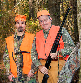
| Blue Ridge WMA - Things To Do: 38,900 acres. Hunting, Camping, Interpretive Trail, Fishing, Hiking, Bird Watching, Picnicking, Horseback Riding. Blue Ridge Wildlife Management Area. Note: Horse and bicycle trails and areas are closed all day during primitive weapons and firearms deer seasons and before 10 a.m. during archery and turkey seasons. No hunting on Camp Merrill. Wildlife: Deer and Bear, Turkey, Small Game, Raccoon, Opossum, Fox, Bobcat, Raccoon, Opossum, Waterfowl, Feral Hogs. Located in Lumpkin and Union counties. Directions From Dahlonega: To the Jones Creek check station: Travel 9 miles west on Hwy. 52 to Nimblewill Rd.; turn right and go 2.4 miles; turn right on USFS Rd. #28 and go 2.4 miles to USFS Road #77; take left fork to check station. To the Rock Creek check station: Take GA 60 north for 28 miles to jct. with USFS Road #69; turn left and go 1 mile to the check station. Blue Ridge WMA Map |
| Broad River Natural Area - Things To Do: 440 acres. Hunting, Fishing, Hiking, and Bird Watching. Wildlife: Deer, Turkey, Small Game, Fox, Bobcat, Raccoon, Opossum. Located in Madison county. Directions From Danielsville: Go north on US 29 for 2 miles; turn right on Hwy. 281; go 4 miles, cross Broad River; go .3 mile, and area is on right.
|
| Chattahoochee WMA - Things To Do: 2,5000 acres. Hunting, Camping, Fishing, Hiking, Bird Watching and Picnicking. Wildlife: Deer and Bear, Turkey, Small Game, Raccoon, Opossum, Fox, Bobcat, Raccoon, Opossum, Feral Hogs. Located in White county. Directions From Helen: Take Hwy. 75 north to Robertstown, turn left on Alt. Hwy. 75; cross bridge; turn right, go 2.8 miles to check station. Chattahoochee WMA Map |
| Chestatee WMA - Things To Do: 25,000 acres. Hunting, Camping, Fishing, Hiking, Bird Watching and Picnicking. Wildlife: Deer and Bear, Turkey, Small Game, Raccoon, Opossum, Fox, Bobcat, Raccoon, Opossum-, Feral Hogs Located in Union and Lumpkin counties. Directions From Cleveland: Take US 129 N 10.5 miles to Turner’s Corner; turn left on US 19; go 0.5 mile; turn right on Dick’s Creek Rd.; go 1 mile to check station driveway on left. Chestatee WMA Map |
|
| Coopers Creek WMA - Things To Do: 30,000 acres. Hunting, Camping, Fishing, Hiking, Bird Watching and Picnicking. Wildlife: Deer and Bear, Turkey, Small Game, Raccoon, Opossum, Fox, Bobcat, Raccoon, Opossum, Feral Hogs Located in Union county. Directions From Dahlonega: Take GA Hwy. 60 north 26 miles to jct. of Coopers Creek Rd; turn right and go 0.5 mile to jct. of USFS Road #236; turn left and go 4 miles to jct. of USFS Road #4; turn right and go 0.5 mile to check station. From Blairsville: Take Old Blue Ridge Hwy west 5 miles to Mulkey Gap Rd.; turn left and travel 8.5 miles to check station. Coopers Creek WMA Map |
| Dawson Forest WMA- Things To Do: 25,000 acres. Hunting, Camping, Interpretive Trail, Fishing, Hiking, Bird Watching and Picnicking. Note: There are 4 different WMA maps for Dawson Forest, Amicalola Tract, Atlanta Tract, Wildcat Creek Tract. Please see the WMA maps page for all the maps. Only bucks with 4 or more points (one inch long or longer) on either side are legal. Horse and bicycle trails and areas are closed all day during firearms deer seasons and before 10 a.m. during archery and turkey seasons. Roads on the City of Atlanta tract are closed to vehicles daily from 10 PM - 6 AM except for individuals legally camping, hunting, or fishing on the area. Wildlife: Deer and Bear, Turkey, Small Game, Raccoon, Opossum, Fox, Bobcat, Raccoon, Opossum, Dove, Waterfowl, Feral Hogs. Located in Dawson and Forsyth counties. Directions From Dawsonville: Take GA Hwy. 53 west 6 miles; turn right onto driveway at kiosk; check station is at top of hill. Dawson Forest WMA Burnt Mountain Tract Map - Dawson Forest WMA-Atlanta Tract MapDawson Forest WMA-Wildcat Creek Tract Map |
| Dukes Creek - Smithgall Woods EEC - Things To Do: 4500 acres. Hunting, Fishing, and Field Trail Access, Interpretive Trail, Bird Watching. Note: Only bucks with 4 or more points (one inch or longer) on either side are legal. For Adult/Child or Honorary License Holders hunt, hunters must apply by letter to WRD-Game Management, 2150 Dawsonville Hwy., Gainesville, GA 30501 by early September. Call for date. Wildlife: Deer, Small Game, Fox, Bobcat, Raccoon, Opossum, Feral Hogs. Located in White county. Directions From Helen: Take Hwy. 75 north to Robertstown, turn left on Alt. GA 75; go 2.2 miles, turn left into Smithgall Woods at Stone Pillars; follow signs to check station. Dukes Creek - Smithgall Woods State Park Map |
| Hart County WMA- Things To Do: 1000 acres. Hunting, Camping, Bird Watching and Picnicking. Wildlife: Deer, Turkey, Small Game, Fox, Bobcat, Raccoon, Opossum, Dove. Located in Hart county. Directions From Hartwell: Take Hwy. 77 south 1.5 miles; turn left onto Liberty Rd.; go 4 miles to the end of the pavement at Cedar Creek; the area lies to the south. Hart County WMA Map |
| Lake Russell WMA - Things To Do: 17,300 acres. Hunting, Camping, Fishing, Hiking, Bird Watching, Picnicking and Horseback Riding. Note: Apply by letter for Adult/Child hunt by Sept. 10 to WRD-Game Management, 2150 Dawsonville Hwy., Gainesville, GA 30501. On Ladies Only hunts, men are restricted to campground. Wildlife: Deer and Bear, Turkey, Small Game, Raccoon, Opossum, Fox, Bobcat, Raccoon, Opossum, Feral Hogs. Located in Habersham, White and Banks counties. Directions From Gainesville: Take Hwy. 365 north about 33 miles to GA 13; turn right; go 2.2 miles and turn left on Ayersville Rd. by the Milliken plant; go 0.9 mile and turn left on Check Station Rd.; go 0.5 mile to check station on left. Lake Russell WMA Map |
|
| Lula Bridge Tract WMA - Amenities: 513 Acres. Wildlife: Waterfowl-Statewide Season. Located in Hall County. Directions from Gainesville: Take US Hwy. 365 north 7 miles from Exit 24; turn left on GA Hwy. 52; go 3 miles; cross Chattahoochee River; turn right into boat ramp parking lot. Lula Bridge Tract WMA Map |
| Swallow Creek WMA- Things To Do: 19,000 acres. Hunting, Camping, Fishing, Hiking, Bird Watching and Picnicking. Wildlife: Deer and Bear, Turkey, Small Game, Raccoon, Opossum, Fox, Bobcat, Raccoon, Opossum, Feral Hogs Located in Towns and Union counties. Directions From Cleveland: Take Hwy. 75 north 20 miles to GA 180; continue on Hwy 75 for 1 mile and turn left at check station sign. |
| Warwoman WMA - Things To Do: 15,800 acres. Hunting, Camping, Fishing, Hiking, Bird Watching and Picnicking. Wildlife: Deer and Bear, Turkey, Small Game, Raccoon, Opossum, Fox, Bobcat, Raccoon, Opossum, Feral Hogs Located in Rabun county. Directions From Clayton: Take US 441 north; turn right on Warwoman Rd.; go 3.5 miles to Finney Creek Rd.; turn left and go 0.2 miles to check station. Warwoman WMA Map |
| Wilson Shoals WMA- Things To Do: 2800 acres. Hunting, Camping, Firearms Shooting Range, Bird Watching and Picnicking. Located in Banks County. Directions From Gainesville: Take Hwy. 365 north 11 miles; turn right on Mud Creed Rd; go 1 mile, turn left; go 0.1 mile, turn right on Yonah Rd.; go 2.1 miles, area on left. Wilson Shoals WMA Map |
| Below, are links to 6 more Georgia WMAs - Click on blue links below for info |
| Region 1 - NW Georgia Mountains WMA Area |
| Region 3 - Mid-Eastern Georgia WMA Area |
| Region 4 - Mid-Western Georgia WMA Area |
| Region 5 - Bottom Western Georgia WMA Area |
| Region 6 - Bottom Eastern Georgia WMA Area |
| Region 7 - Georgia Coastal WMA Area |
|
|
|


GA Wildlife Areas:
Bird Watching
Public Fishing Areas (PFA)
Horseback Riding
Fish Hatcheries
Archery & Firearms Ranges
Range Rules
License & Regulations:
PFA Hunting
|