|
|
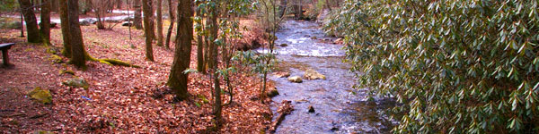
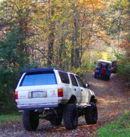
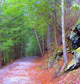
The system is made up of interconnecting dirt trails, rock hill climbs and gravel roads through the Chattahoochee National Forest. It is recommended for experienced riders, only, due to its challenging terrain and steep ascents. |
| Beasley Knob OHV Trails General Information |
Trail Description: 10.6 miles length. The Beasley Knob OHV Trail System is a challenging trail system located off of U.S. Highway 76 in Union County Georgia. It is conveniently located two miles east of the town of Blairsville and can be accessed by two trailheads. The system provides approximately 10.6 miles of recreational riding for OHV enthusiasts, including those riding four-wheel drive vehicles, motorcycles and ATVs. The system is made up of interconnecting dirt trails, rock hill climbs and gravel roads through the Chattahoochee National Forest. It is recommended for experienced riders, only, due to its challenging terrain and steep ascents. Click here to see a Beasley Knob OHV Trail map.
NOTE: Call before driving out. Trail is frequently closed due to rain and bad weather. Many of the trails within this system are classed as difficult to most difficult. This area is recommended for experienced riders only.
Open Dates: The Beasley Knob Trails are open from sunrise to sunset. Expect delays due to construction on trail.
Class of Vehicles Permitted: ATV, 4x4 and Motorcycle
Permit Fees: 1-Day Permit: $5 per operator per day. Pay at site.
Restrictions: No bolted, studded or tire chains allowed. No night riding. The Forest Annual Pass cannot be used on this trail system.
Closest Towns: Blairsville, GA is 2 miles away.
Water: None
Restroom Facilities: Vault Toilet located at the Satterfield Trailhead |
|
| GPS Location, Directions & Contact Info |
GPS Location: Latitude 34.882230 and Longitude -83.924598
Directions: There are two parking areas from which to enter the OHV trail system.
Satterfield Trailhead - Beginning on US 76/Highway 515 in front of the Blairsville Post Office, go east for 0.7 mile. Turn right onto Windy Hill Road, a paved road. At 0.7 mile when Windy Hill curves sharply to the left, go straight onto a gravel road. After 0.1 mile, turn left onto a narrow gravel road, Forest Service Road #851. Continue 0.8 mile to the OHV trail system parking lot.
Blue Rock Trailhead - Beginning on US 76/Highway 515 in front of the Blairsville Post Office, go east for 3.4 miles. Turn right just before two large propane tanks onto Rosemary Lane, which is also Forest Service Road #93. At the first fork, go left. At the second fork go right. Follow the road to the parking lot at the end, a total of 1.6 miles.
USDA Forest Service, Blue Ridge Ranger District - Phone: 706-745-6928
Address: 2042 Highway 515 West, Blairsville, GA 30512 - Office hours: Monday - Friday at 8-12 & 1-4:30 pm
Chattahoochee-Oconee National Forests - Phone: 770 297-3000
Address: 1755 Cleveland Highway, Gainesville, GA 30512
Office hours: Tuesday - Friday at 9 - 12 & 1-4 - Closed Saturday, Sunday, and Monday |
|
| |
|

Georgia US Forest Areas
 Camping Hiking Camping Hiking
Horseback Riding Trails
FishingCanoe Trails
GA US Forest Wilderness
Wilderness Preparation
Canoe Safety Tips
Forest Safety Tips
GA U S Forest History
|