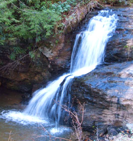
| Description The logging roads that once ran along the streams, waterfalls, rocky outcroppings, and high peaks that distinguish the Chattahoochee Wildlife Management Area are rapidly returning to their natural state. The mountains (Horsetrough is the highest at 4,045 feet) are covered in second-growth upland and cove hardwoods in excess of 60 years of age. Trout fishing is top-notch, with 65 miles of streams chock-full of rainbows, brookies, and browns. Some of the headwaters of the Chattahoochee River flow through here. Deer, squirrels, raccoons, grouse, and wild turkeys dominate among the landlubbing residents, with smaller populations of black bears, woodcocks, and doves. Most hikers take the Appalachian Trail (AT), which follows the crest of the Blue Ridge through this area for 14 miles. The two shelters on the AT are Low Gap and Blue Mountain. Jack's Knob Trail enters the Wilderness at Henry Knob and travels south before dividing and joining the AT in two places. Less than an hour's hike on a trail on the east side leads to Horsetrough Falls, which plunges year-round. Hunters and anglers are common sights, and hikers appear almost every day from spring through fall. Just across State Highway 75 lies Tray Mountain Wilderness. Contact: Blue Ridge Ranger District (Blairsville office) - Phone: 706-745-6928 - Address: 2042 Highway 515 West, Blairsville Georgia 30512 |
||
| Area Management The Mark Trail Wilderness is part of the National Wilderness Preservation System, set up by the Wilderness Act of 1964 to keep these lands wild. Please use Leave No Trace practices when you visit. |
||
| General Wilderness Prohibitions As in all designated wilderness, motor vehicles, motorized equipment and mechanical transport (including bicycles, carts and wagons) are generally not allowed, and aircraft may not land. Contact the ranger district listed on this page about any exceptions. |
||
|
||
The following wilderness regulations are in effect for this area. Not all regulations are in effect for every wilderness. Contact the Forest Service office for more specific information about the regulations listed.
 Dogs Restricted - Leased-Under Control Pets must be on a leash at all times. Stock use is prohibited Hitching, tethering or hobbling a horse or other saddle or pack animal closer than 50 feet from a stream or body of water is prohibited, possessing or using a saddle, pack or draft animal on developed trails which has been closed to use by horses and so posted as prohibited. |
||
| The priority for the Forest Service during the 1960's and 1970's was to restore badly eroded lands on the Oconee and restore forest health. During the 1960's construction efforts were undertaken to provide developed recreation areas within 50 miles of every major town. Brasstown Bald Visitor Information Center atop Georgia's highest mountain and Warwomen Dell are examples of areas built as a result of this effort. | ||
| The next four decades saw increased environmental legislation that governs management of the national forests to protect environmental quality and insure public involvement in the process. Wilderness areas were preserved, Wild and Scenic Rivers designated, and experts in natural resource management were employed to help meet the challenges. While the way we do things have changed many times over the years, our tradition of stewardship--caring for the land and serving people, is the same. | ||
|
||