|
|
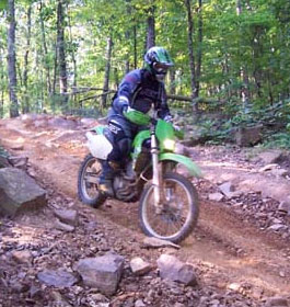
These 5.5 miles of wooded trails are suitable for mountain bikes, motorbikes, ATVs and 4-wheel drive vehicles. The trail follows an old woods road along the ridge line of Tatum Mountain throughout dense forest. |
| Tatum Lead ORV Trails - General Information |
OHV Trail Riding - Tatum Lead connects to Rock Creek ORV Trail. Other acitivities here are Mountain Biking and Day Hiking. There is no charge to use this trail system.
The trail dead ends to the south at a mound of direct on the government property boundary. However, four-wheel drive vehicles must enter off GA 52 about 0.8 mile east of the Cohutta Lodge on Fort Mountain. Note: After turning off GA 52, the first 2 miles of road is a right-of-way across private land. Only licensed vehicles with tags are permitted on the first 2.7 miles of road which is a public Right-of-Way across private land. Trail ends at private property. Do not ride beyond the end of the trail.
OHV Length 5.5 miles
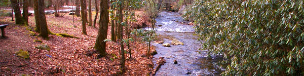
- Open Year Round - No Water or Restroom Facilities |
|
| Contact & Directions |
USDA Forest Service, Conasauga Ranger District office - Phone: 706-695-6736 Address: 3941 Highway 76, Chatsworth, GA 30705
The Conasauga Ranger District covers the western third of the Chattahoochee National Forest. A diverse set of landscapes make up the Conasauga district, from the ridges and valleys west of Interstate 75 to the Cohutta Mountains northeast of Chatsworh, GA. This part of the forest offers some of the best scenery and outdoor recreational activities in north Georgia.
Chattahoochee-Oconee National Forests - Phone: 770 297-3000
Address: 1755 Cleveland Highway, Gainesville, GA 30501
Office hours: Tuesday - Friday at 9 - 12 & 1-4 - Closed Saturday, Sunday, and Monday
Directions: Take GA 52 east from Chatsworth about 1 mile. Turn right onto the Old Federal Road and go 4 miles. Turn left at the Peeples Lake/Rock Creek Trail directional sign onto Forest Service Road 3 and travel 5.9 miles to the trailhead parking lot. |
|
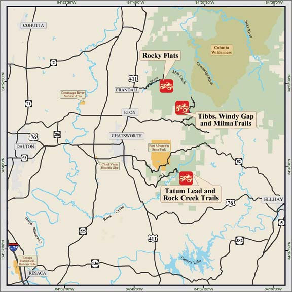
Multiple ORVs Vicinity Map |
|
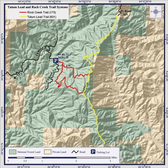
Tatum Lead and Rock Creek ORV System Trails |
| |
|

Georgia US Forest:
 Camping Hiking Camping Hiking
Horseback Riding Trails
FishingCanoe Trails
GA US Forest Wilderness
Wilderness Preparation
Canoe Safety Tips
Forest Safety Tips
GA U S Forest History
|