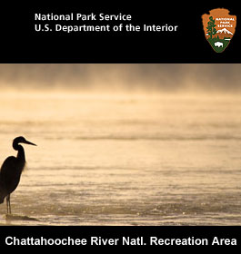
Chattahoochee River Recreation Area National Park - An Ancient River in a Modern City. Take a solitary walk to enjoy nature’s display, raft leisurely through the rocky shoals with friends, fish the misty waters, or have a picnic on a Sunday afternoon.
Chattahoochee River Attractions
The river offers excellent opportunities for leisurely paddling a raft, canoe or kayak to observe wildlife and wildflowers, do some fishing, or simple relaxing recreation.
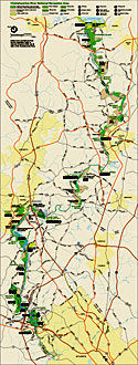
The Chattahoochee National Recreation Area contains 16 park units with a total of 50 miles of hiking trails, a Visitor Contact Station at the Island Ford Unit, numerous picnic areas, canoe, kayak and raft rentals. For more information call the Visitor Contact Station at 678-538-1200.
On days when Buford Dam is not releasing water, the river below the dam is calm "flat water" with an occasional class I/II shoals or rapids. Currents can be strong around submerged rocks and jagged tree snags that are found in the river. Rubber-soled shoes are a must for tackling slippery rocks and the occasional broken glass bottle.
The river is accessible by boat North of Morgan Falls Dam at Bowmans Island, Abbotts Bridge, Medlock Bridge, Jones Bridge, Island Ford, and Chattahoochee River Park along Bull Sluice Lake.
South of Morgan Falls Dam the river is accessible by boat at Morgan Falls Park, Johnson Ferry, Powers Island and Paces Mill.
Even if you don't have your own boat to use, there is equipment available for rental. The Chattahoochee NRA does not rent boats directly, however there are several vendors licensed to rent canoes, kayaks, rafts, and tubes for day use on the river. Park fee.
Fishing on the Chattahoochee
The Chattahoochee River is a stocked trout stream with 23 species of game fish. Year-round fishing is available with a Georgia fishing license and a trout stamp.
Fishing the Chattahoochee River year-round for its trout, bass, catfish, and other species can be a great experience. The river stays a cool temperature year-round, rarely getting warmer than 50 degress Farenheit. The river within the park is open for fishing from 30 minutes before sunrise until 30 minutes after sunset. Night fishing is not permitted in the park.
Anglers need to follow Georgia fishing regulations. A valid Georgia fishing license is required for anglers age 16 and older. Additionally, all resident anglers ages 16 to 64 and nonresident anglers age 16 or older must have a trout stamp. Visit the Georgia Department of Natural Resources website at www.gofishgeorgia.com for more fishing license and regulation information.
The Chattahoochee has restrictions on bait during certain sections of the river and in certain seasons.
Fishing Regulations
Within the park, there are 3 special regulation sections. The first concerns live bait-fish. Live bait-fish may only be used downstream of the GA 9 highway bridge, except at certain times in the delayed harvest section. The seining of bait-fish is not allowed at any time.
The next allows artificial lures only year-round. This 15 mile section is located from GA 20 Hwy to the boat ramp at Medlock Bridge just upstream of the GA 141 Hwy bridge. In this artificial lure section, it is unlawful to use or possess any other type of bait.
The last section covers delayed harvest. This five mile section is located from Sope Creek (off Columns Dr) downstream to U.S. Hwy 41 (Cobb Pkwy). Anglers must release all trout immediately and use and possess only artificial lures with single hooks from November 1 through May 14 annually. Anglers fishing for species other than trout must abide by the artificial lure only regulation while fishing in the delayed harvest section. These restrictions do not apply in this delayed harvest section from May 15 to October 31 of each year.
U.S. Coast Guard approved personal flotation devices are REQUIRED TO BE WORN if you are boating, tube floating, or wading in river areas between (1) Buford Dam and the GA 20 highway bridge and (2) between Morgan Falls Dam and the boat ramp at Morgan Falls parking lot. On all other river sections in the park, you must have a wearable, appropriately sized, U.S. Coast Guard approved personal flotation device on board all vessels for each person. All children under age 10 MUST WEAR a U.S. Coast Guard approved personal flotation device when the vessel is underway.
Hiking - The park is spread over a 48 mile section of the Chattahoochee River and consists of 16 different areas or units beginning at the below the Lake Lanier dam in Forsyth County and ending at Peachtree Creek in Fulton County, in metro Atlanta.
Operating Hours & Seasons
Island Ford Visitor Contact Station at Island Ford is open daily from 9 am to 5 pm except on December 25th. Day-use only. The park is open from dawn to dusk year round. Dawn is defined as 30 minutes before legal sunrise and dusk is defined as 30 minutes after legal sunset.
Contact, Address & Directions
Phone: 678-538-1200 - Address: 1978 Island Ford Pkwy, Atlanta, GA 30350
Directions Northbound GA 400 - Take exit #6 (Northridge Road). Coming off the exit, stay in the right lane, cross over GA 400, and turn right onto Dunwoody Place. Go 0.5 miles to Roberts Drive. Turn right and proceed 0.7 miles to the park entrance on your right.
Southbound GA 400 - Take exit #6 (Northridge Road). Continue straight ahead at the traffic light onto Dunwoody Place. Go 0.5 miles to Roberts Drive. Turn right and proceed 0.7 miles to the park entrance on your right.
Call the Visitor Contact Station at 678-538-1200 for questions.
History and Culture
The southern Appalachian Mountains are ancient mountains. Once as tall and rugged as the Alps, these ancient mountains have been changed by the hand of geologic time. Today they are cloaked in a dense mantel of diverse vegetation; oak, hickory, and hemlock; rhododendron, laurel, wildflowers and ferns. These mountains are home to the bear, turkey, and salamander.
This rugged wilderness gives rise to an ancient river, the Chattahoochee. Seeping from a small patch of sand and gravel on the south slope of Jacks Knob; just 100 meters south of Chattahoochee Gap on the Appalachian Trail. Fed by many springs and tiny tributaries, the river grows quickly as it travels down the steep mountainside.
With cascades, crashing falls, and crystal clear water, the river, rushing about boulder and log, leaves the Appalachians, traverses the piedmont province, enters the coastal plain, and finally adds its waters to the Gulf of Mexico to create the nursery of the Apalachicola. It was, according to some geologists, a greater river that created this corridor. However, over the millennia, tributary waters were taken by the savannah and Tennessee Rivers through Geologic stream capture.
Through the millions of years and the grand changes of the Earth, the river stayed its course under the influence of the Brevard Fault. In very recent times, geologically speaking, the river was shrouded in a dense cloak of fog providing protective insulation for broad-leafed hardwoods and herbaceous plants. As the ice receded in the far north and the climate warmed, the plants migrated from the river corridor disbursed by water, wind, and wildlife. In time the piedmont and mountains held a rich and abundant diversity of natural resources. The ancient Chattahoochee continued to flow from the mountains and across the piedmont. Our term, Piedmont, comes from the Italian word, piemonte, “at the foot of the mountains”. Once mountainous itself, the piedmont has worn to rolling hills, punctuated by the occasional lone mountain and dissected by steep stream ravines.
And so it was this wealth of resources, some 8,000 years ago; not ever eyes blink in geologic time; attracted humans. Palieo, Archaic, Woodland, Mississippian, and finally, during historic times, Cherokee and Creek all used the river corridor in turn. Soon persons from Europe and Africa entered the piedmont. Coexistence was replaced by removal because of rich farmlands, abundant water power, and very high grade gold. Mills along Rottenwood, Sope, and Vickery Creeks produced flour, cornmeal paper, and textiles. Farms flourished and gold was removed from hillsides and streambeds. The mills; operating 24 hours a day, 7 days a week; employed hundreds of workers. That is until July of 1864 when General William T. Sherman arrived with his army. The mills were burned, many skilled workers were exiled to the north, and surprising the army of the south; Union Forces crossed the river at Sope Creek flanking the Confederates.
Over time much was rebuilt, some enterprises succeeded, some faded away, times were often difficult along the river.
The Chattahoochee River National Recreation Area (CRNRA) consists of a 48-mile stretch of the Chattahoochee River and 14 land units along its corridor. It begins at Lake Lanier's Buford Dam, near Buford, Georgia, and continues downstream through four counties to Peachtree Creek near downtown Atlanta. CRNRA provides outdoor recreation for more than 3 million visitors a year. It is an important resource for this urban area that is experiencing unprecedented population growth and development.
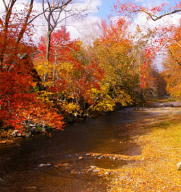
CRNRA is a place rich in natural and human history, each influenced by the river's pervasive force. Usually clear, cold, and slow moving, the river sometimes plunges as a muddy torrent through its rockbound shoals. For centuries people have been drawn to the river for food, transportation, and for power to sustain the mills, factories, and homes built along its banks.
Today the river attracts us for different reasons. People come to float down the river, as the locals will say, "shoot the 'hooch", hike the trails along its banks, fish in its cold water, and simply relax. Wildlife is abundant in the park. Some animals you will see every time you visit CRNRA and some, like the playful river otter, will delight you with a rare appearance.
Interesting Chattahoochee River Facts
The Canada Goose is a year-round resident of the Chattahoochee River. Once pushed to the brink of extinction by over-hunting and habitat loss, Canada Geese have made a comeback thanks to re-introduction programs and better management of hunting practices.
Prehistoric people would shelter under the large rock overhangs found along the Chattahoochee River. Indian village sites once flourished along this rich corridor of fertile soils.
Jones Bridge spanned the Chattahoochee River from 1904-1922 falling into disrepair in the 1930's. Half of the bridge was "stolen" in 1940, neighbors didn't know the workers cutting the bridge were not authorized to do so until it was too late.
Trout have a protective membrane or "slime coat" that covers their scales and is their first line of defense against infection and disease. Damage to this coating can severely hurt the fish. Wetting your hands or limiting contact with the fish increases the likelihood that the fish will survive.
Typically, rivers meander and change course over time. However, the Chattahoochee River is one of the oldest and most stable river channels within the United States, since it's essentially "locked" in place, flowing along the Brevard Fault Zone.