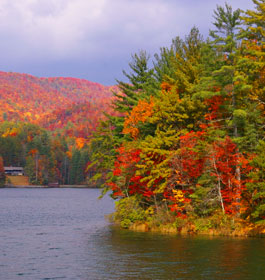
Fun Recreation and Fishing at Lake Rubun, Lake Seed and Tallulah Falls - Lake Rabun is an 834-acre lake located a few miles downstream of Lake Burton near Clayton. This mountain reservoir is long and narrow with miles of steep, rocky shoreline.
General Information
The upper two miles of the lake are relatively shallow and contain mud flats with weed beds along the river channel and long sections of blown down trees. Angling prospects are compiled by fisheries biologists and are based on sampling efforts of the Georgia Dept. of Natural Resources (DNR), knowledge of past fishing trends, angling experience and information provided by anglers and marina owners. For more information, contact Wildlife Resources Division, Burton Fisheries office at 706-947-3112.
Attractions and Parks
Lake Rabun is just a short drive from historic Clayton GA. The 835-acre lake has facilities for boating and fishing as well as camping and lodging. Nacoochee Park is just one of the recreation areas along Lake Rabun's 25 miles of shoreline. Located on the north end of the lake, Nacoochee Park recreation area is perfect for a picnic, fishing on a river-like setting or just relaxing. There is also a view of the Nacoochee dam and powerhouse. The park contains picnic facilities, restrooms and a bank fishing area. It is located just off of Lake Rabun Road.
Rabun Beach (USFS) - Overlooking beautiful Lake Rabun and the north Georgia mountains, this recreation area offers camping, hiking, swimming, boating and fishing. 80 tent and trailer campsites are available, some with electrical and water hookups.
Lake Seed, with its 13 miles of shoreline, has many recreational opportunities to offer. The 240-acre lake features swimming, boating and camping. Seed Campground provides an area for primitive camping, just one way to spend your weekend on Lake Seed. It is located at Crow Creek Rd off Burton Dam Rd in
Lakemont, GA.
Lake Seed Campground - This natural, primitive camping area lies on the west side of Lake Seed. The park provides tent camping areas, picnic areas, restrooms, drinking water, and a beach with a swimming area. The park can be reached via Crow Creek Road on the west side of the lake.
Lake Seed Boatramp - In keeping with the peaceful and quiet setting of Lake Seed, this facility is intended for small boats only. It is on the east side of the lake off of Lake Rabun Road.
Tallulah Falls - Discover the serenity and grandeur of north Georgia's rivers and mountains at spectacular Tallulah Gorge State Park. Plunging 1,000 feet, Tallulah Gorge has five major waterfalls which can be viewed from observation decks on an easy walking trail high above. During scheduled Spring and Fall weekends, water releases from the dam recreate the tumultuous stream that cut the chasm. Other times of the year, shallower water and a strenuous hike (register first) will enable visitors to reach and explore the bottom.
Located on the north rim of Tallulah Gorge, the interpretive center is a great starting point. The exhibits in the center explain many intriguing facts about the production of electricity, the plants and wildlife of the region and the history and culture of the early settlers.
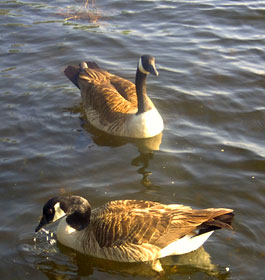
The park, with its many native trees and shrubs, has three trails. One circles a small pond where ducks and other water fowl often can be seen. The Terrora Trail starts at the Old Tallulah Falls Jail and meanders around the edges of the Tallulah Lake. The North Rim Trail is the most visited of all. Breathtaking views of Tallulah Gorge and its waterfalls are around every bend. And now you can cross the gorge for a birds-eye view on a new suspension foot bridge.
The park has picnic tables, restrooms and a white sand beach. A well-equipped playground provides fun for young visitors while lighted tennis courts and a big playing field attract all age groups. The covered pavilion with a stage and dressing rooms is a perfect place for a gathering of family and friends or for performances and crafts to share with others. A small fee reserves the pavilion for your activities.
Tallulah Point is a scenic and relaxing park with picnic tables and restrooms. It is located at 940 Tallulah Gorge S, Tallulah Falls, GA
Terrora Campground, located on the north side of the Gorge, has 50 campsites that are fully equipped with electricity and water hook ups, tables and grills, and hot showers available in the comfort station. There is a playground and a pavilion for camper's use. A resident camp host oversees the campground during the summer.
Boat Ramps
Information on Georgia Power-operated boat ramps can be found using the contact info below.
Best Fishing Bets
Largemouth Bass & Spotted Bass -
Largemouth and spotted bass are equally abundant in Lake Rabun. For largemouth bass, anglers can expect to catch higher numbers of fish in the 14 to 16-inch size range than in years past, whereas spotted bass in the 16 to 18-inch class are present in higher numbers this year.
Technique - Bass in Lake Rabun will take advantage of any opportunity to grab a passing blueback herring, which gives lures like the pearl-colored Super Fluke or Pointer series a unique advantage among artificial lures.
During the spring and fall months, work a 3/8-oz jig-head tipped with a fluke in prime target areas. Switch to finesse worms on points, humps and creek channels when the fluke is not attracting strikes.
Target - Largemouth bass anglers should generally target visible woody structure along the shoreline in coves and small pockets. In the summer months, look for largemouth bass in 20 feet of water along main lake points and in creek channels. Spotted bass change habitat preferences seasonally from inshore to open water habitats. During the spring months, search for spotted bass on the lower lake around the corners of boathouses near deep water. In early summer, look for surface feeding activity on the lower lake in the early morning and late evening hours. During the fall months, spotted bass will feed on herring at the surface as well as crayfish on the bottom along points.
Walleye population continues to grow larger due to annual stocking. In fact, fall surveys for the
last two years indicate that walleye are more abundant than spotted bass. As a result of this expanding
population, anglers are catching more and more walleye. A wide range of size classes roam the open waters of
the lake, including state record class walleye that top 11 pounds.
Technique - Three seasonal patterns have emerged. During March and early April, walleye are in a spawning
pattern. Fish the shallow headwaters at night with floating minnow imitations, white curly-tailed grubs or
nightcrawlers. During the day, fish the deeper sections of the river by trolling nightcrawlers along the bottom
or by casting crankbaits in perch, shad or crayfish color patterns. From June to September, walleye transition
into a summer pattern and as the water warms, they migrate to deeper waters near the dam in search of cooler
temperatures. Troll the same types of lures and baits already mentioned along the bottom at a depth of 30 feet.
When water temperatures cool in October and November, walleye switch to a fall pattern where they move onto
shallow water points in the evening to feed, and during the day, remain on the bottom in nearby deeper water.
Target - During the spawning pattern, anglers can fish from the shoreline at Georgia Power’s Nacoochee Park,
which is located at the intersection of Low Gap Road and Seed Lake Road downstream of Nacoochee Dam. During the summer and fall patterns, troll the lower lake from Hall’s Marina to the dam. DNR saturated the cove directly across the lake from Hall’s Marina with artificial structure specifically placed at the critical depth range to attract walleye. Newcomers to Lake Rabun may want to explore this “Walleye Habitat Area” first by bouncing nightcrawlers along the bottom in a 100-foot wide radius around the marker buoy.