|
 Enjoy waterfront campsites. Camp in comfort or really rough it. The Corps of Engineers maintains several campgrounds considered to be some of the finest in the Eastern U. S. Campers may stay for as long as 14 days in any 30 day consecutive period; longer stays require the prior approval of the Resource Site Manager. Enjoy waterfront campsites. Camp in comfort or really rough it. The Corps of Engineers maintains several campgrounds considered to be some of the finest in the Eastern U. S. Campers may stay for as long as 14 days in any 30 day consecutive period; longer stays require the prior approval of the Resource Site Manager.
Camping Reservations for all parks below: Phone 1-877-444-6777 or reserve online at ReserveUsa.com. Reservations may be made 6 months in advance of the arrival date.
Big Hart Campground is located at the confluence of Big Creek and Hart Creek on the western end of beautiful J. Strom Thurmond Lake, the largest Corps of Engineers lake project east of the Mississippi River. The campground has 24 water/electric hook-ups, and 7 non-hook-up sites, all spacious and shaded. The campground is adjacent to Big Hart Recreation Area, with a swimming beach, playground, dock, dump station and boat ramp. It also features a group tent area, which includes a large picnic shelter with 30 amp electrical service.
Family sites range from $16-$20. Campsites will accommodate two tents or one RV and one tent. The group area capacity is 30 people and the fee is $75 per night. The group area has a shower/restroom facility with hot water and electricity. Public use of alcohol is prohibited. Pets allowed if penned or leashed. Gates open at 7 a.m. and close at 10 p.m.
Reservations must be made at least 2 days in advance. 2 night minimum on weekends. 3 night minimum on holidays.
 Check-in time is 3 p.m. and check-out time is 2 pm. Check-in time is 3 p.m. and check-out time is 2 pm.
Late check-out may result in the charge of an additional night's camping fee.
Visitor hours end at 9:30 pm.
Maximum 4 vehicles per site.
For current lake conditions, contact the lake office at (706) 595-8613.
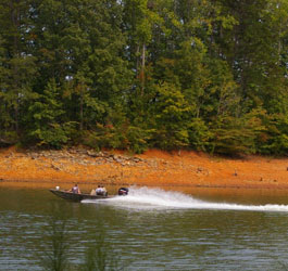
Visitors are encouraged to wear life jackets at all times while on or around the water.
Swimmers should use designated swim areas and never swim alone.
Big Hart Campground Map |
| Campgrounds |
|
Broad River Park and Campground features double and triple sites, All sites are equipped with water and 30 AMP electrical hook-ups. It is the only boating access to the Broad River.
Hawk Creek Park and Campground: 28 campsites with water and 30 and 50 amp service hook-ups. Two accessible shower/restroom facilities, dump station, and a boat launching ramp are available. This park features boat ramp, bathhouse, showers, fish cleaning station, dump stations, electrical hook-ups, shower/bath house, campsites and fish cleaning stations. Pets allowed if penned or leashed.
Family site fees range from $18-$20. Double and triple sites range from $36-$60, and full payment is required for the site despite number of camping units. Double sites accommodate two motorized vehicles and a tent. Single family sites accommodate two tents or a RV and a tent. Gates open at 7 am and close at 10 pm.
Phone: (706) 359-2053 and toll-free at (800) 533-3478
Address: 8181 Elberton Hwy., Tignall, GA 30668
Directions: I-20 to exit 172, go west on Hwy 78 to GA Hwy 43 north to Lincolnton. GA Hwy 79 north to Broad River.
Broad River Park and Campground Map |
Bussey Point Park - Enjoy nature at its finest. Located at the entrance of the Bussey Point wilderness recreation area - a 2,545 acre peninsula on J. Strom Thurmond Lake - the campground provides a relaxing getaway for the nature enthusiast whether it is hiking, mountain biking, or horseback riding. Currently under construction and almost completed is the Bussey point horse trail.
Created by horseback riders, for horseback riders, this trail circles the peninsula and is 12.5 miles long. Along with the horse trail there are an additional 20 miles of roads and trails located within the area that are welcome for use by all (no motor vehicles please). Located within the area are 15 food plots, six hike/bike/ride/boat in camping picnic sites (4 under construction) an observation tower, and several natural beaches. Ample deer and turkey inhabit the area along with other mammals and birds to provide one of the best opportunities on the lake to view wildlife in its natural setting.
Adjacent to the area is a campground that has 10 primitive campsites without water and electricity. There are picnic tables, fire rings, and grills located at each campsite. 10 additional campsites Currently under construction, developed in cooperation with the Georgia Horse Council they were created with the needs of campers with horses in mind. There is a boat launching ramp, hand pump for drinking water, and rustic toilets located throughout the area.
Sites are $6 payable at an honor vault located at the campground entrance. Each campsite has a grill, picnic table, and fire ring. A boat ramp, rustic toilets, and a hand pump for drinking water are located within the campground.
Directions: From the Hwy. 47 Little River Bridge in Lincoln County GA, go north 1.8 miles and turn right on Ashmore-Barden Rd. Go 3 miles to stop sign and turn right on Double Branches Rd. Go 3 miles until pavement ends. Continue straight on dirt road 0.5 miles to check station and parking area. |
|
Clay Hill Park and Campground is located on the north side of Georgia’s Little River Section of J. Strom Thurmond Lake. The campground is just a stones throw from Mistletoe State Park by boat, and only 4 miles from Amity Recreation Area one of the largest recreation areas on the lake offering beaches, picnic sites and reservable group shelters along with a fishing pier. The campground has 7 primitive campsites and 10 improved campsites with water and electrical. A comfort station is located within the park with showers and restroom facilities, and a dump station for campers is also located inside the park. The shoreline of Clay hill offers excellent fishing for Bluegill and other species of bream. A boat launching ramp is located within the campground. See Clarks Hill Fishing for more info.
Site fees range from $12-$16 per night. Pets are allowed if penned or leased. Public use of alcohol is prohibited. Gates open at 7 am and close at 10 pm.
Directions: From interstate 20 exit 172 take U.S. 78, 4 miles to GA 43, continue to Amity Woodlawn road and follow signs to the campground.
Clay Hill Park and Campground Map |
Hawe Creek Park and Campground is located one mile from the Dorn Boating and Sportfishing Facility, the largest boat launching and sportfishing facility in the Southeastern U.S. Near South Carolina State Parks, Hickory Knob and Baker Creek. The campground has 28 campsites with water and 30-amp or 50-amp service hook-ups. 2 accessible shower/restroom facilities, dump station, and a boat launching ramp are available.
Sites range from $20-$22. Public use of alcohol is prohibited. Pets are allowed if penned or leashed. Gates open at 7 a.m. and close at 10 p.m. Sites accommodate two tents or a RV and a tent.
Directions: From the junction of U.S. Highway 221 and U.S. Highway 378 in McCormick, SC, go SW on U.S. 378, then south 4 miles on Chamberlains Ferry Road. Road ends at campground.
Hawe Creek Park and Campground Map |
|
Hesters Ferry Park and Campground is reported to be some of the best fishing on the lake. 26 shaded campsites on the lake. All the sites are on the water. Some sites equipped with water and electrical hook-ups. A separate loop has 10 primitive sites. Camping fees range from $16-$18 per night. Sites accommodate two tents or a RV and a tent. Pets allowed if penned or leashed. Public use of alcohol is prohibited. Gates open at 7 a.m. and close at 10 p.m.
Phone: (706) 359-2746 and toll-free at (800) 533-3478
Address: 1864 Graball Road, Tignall, GA 30668
Directions: Ga Hwy 79 North of Lincolnton to Fishing Creek Rd.
Hesters Ferry Park and Campground Map |
Leroys Ferry Park and Campground is located 5 miles south of Historic Willington on the South Carolina Heritage trail. The ultimate out of the way camping experience the park has ten primitive campsites without water or electrical hookups. However there is a boat ramp with security light, rustic toilets, a hand pump for drinking water, and nothing but the quiet sound of nature as you relax and get away from the hustle and bustle of the city, and congested campgrounds.
Sites are $6 payable at an honor vault located at the campground entrance. Each campsite has a grill, picnic table, and fire ring. A boat ramp with a security light, rustic toilets, and a hand pump for drinking water are located within the campground.
Directions: From the junction of U.S. Highway 221 and U.S. Highway 378 in McCormick, SC, go North on SC 28 and turn left onto SC 81, Follow for approximately 12 miles to the town of Willington (don’t blink) follow the signs to the campground. |
|
Modoc Park and Campground - Within the campground, two peninsulas jut out into the lake,
with water front sites and expansive views of the lake and surrounding forest. 3 shower facilities, 49 sites, launching ramp, playground and hiking trail. Pets allowed if penned or leashed.
Camping fees range from $16-$22 per night. Sites accommodate two tents or a RV and a tent. Pets are allowed if penned or leashed. Public use of alcohol is prohibited. Gates open at 7 a.m. and close at 10 p.m. Directions: From I-20, take exit 200 (River Watch Parkway). Turn right; drive 2 miles to Furys Ferry Road (Hwy. 28 West). Turn right; drive 13 miles to Clarks Hill, SC. Continue northwest on Hwy. 221 for approximately 4 miles to campground entrance sign, turn left.
Modoc Park and Campground Map |
Mount Carmel Park and Campground - Located in the Old Ninety-Six Tourism area in South Carolina, Mt. Carmel Campground is remote and quiet. Many of the campground's sites are a stone's throw from the shoreline at Thurmond Lake. 21 of the sites are equipped with electric (30-amp) and water. The remaining 22 sites are for tent camping. Two boat launching ramps are near by, one just outside and one inside the campground for campers only. Locally known as Hesters Bottom, Mt. Carmel provides a perfect place for campers who truly want to get-away-from-it-all. Some sites equipped with 30-amp electric and water. The remaining 22 sites are for tent camping. Two boat launching ramps are near by. Pets are allowed if penned or leased.
Site fees range from $16-$18 per night. Public use of alcohol is prohibited. Gates open at 7 am and close at 10 pm. Sites accommodate two tents or a RV and a tent.
Directions From I-85, take Exit 11 near Hartwell Lake, and take Savannah River Scenic Highway (Hwy 24, to Hwy 187, to Highway 81) south approximately 51 miles. The campground is approximately nine miles south of Calhoun Falls, SC. Turn left at campground sign.
From I-20, take exit 200 to River Watch Parkway. Turn right; drive 2 miles to Furys Ferry Road (Hwy. 28 West). Turn right; drive 13 miles to Clarks Hill, SC. Continue northwest on Hwy 28/221 to McCormick, SC. Go northwest 15 miles on Hwy 28, turning on to Hwy 81 five miles north of McCormick. Campground sign is in Mt. Carmel, SC. Follow road to campground.
Mount Carmel Park and Campground Map |
|
Petersburg Park and Campground - Nearest campground to Augusta, GA, Petersburg is the largest Corps of Engineers campground on J. Strom Thurmond Lake. Boasting 93 sites, most with water and 30-amp and 50-amp electrical service, this campground is open year round. Two swimming beaches, a fishing pier, a hiking trail, a pond, and a first-come-first-serve picnic shelter provide for plenty of recreation opportunities right in the campground. A boat ramp for campers gives access to the 70,000 surface acres of water of Thurmond Lake. Nearby Lake Springs Day Use Area offers group shelters, playgrounds, a three-lane launching ramp, and numerous beaches. Petersburg is 4 miles from the Thurmond Dam and Visitor Center.
Site fees range from $16-$22 per night. Pets are allowed if penned or leased. Public use of alcohol is prohibited. Gates open at 7 a.m. and close at 10 p.m. Sites accommodate two tents or a RV and a tent.
Directions: From I-20, take GA Hwy 104 (Washington Rd.) approximately 20 miles to intersection with U. S. Hwy 221 at Pollard's Corner. Turn right and travel two miles NE on Hwy 221 to campground sign. Turn left on paved road to campground.
Petersburg Park and Campground Map |
Raysville Park and Campground is located on Georgia's Little River section of J. Strom Thurmond, the largest Corps lake east of the Mississippi River. Just nine miles from Thomson, GA, Raysville is all-electric: all 55 sites are equipped with electric(30-amp), and water, hook-ups. Within a mile is the Amity Recreation Area, with numerous beaches, picnic shelters and sites, and ball field. Each July 4 holiday, a local boat club sponsors fireworks at Amity, and Raysville offers some of the best seats to see the show.
Site fees range from $20-$22 per night. Pets are allowed if penned or leased. Public use of alcohol is prohibited. Gates open at 7:00 a.m. and close at 10:00 p.m. Sites accommodate two tents or a RV and a tent.
Directions: From I-20, take Thomson Exit 172 (Hwy 78) north 3 miles, turn right on Hwy 43. Go 5 miles to campground sign, turn left into campground.
Raysville Park and Campground Map |
Ridge Road Park and Campground - Out on the peninsula where Ridge Road ends is one of the first campgrounds on J. Strom Thurmond Lake. Ridge Road still has some of the most beautiful views from campsites on Thurmond Lake. Sixty-three of the 69 sites are equipped with water and electrical services (30-amp and 50-amp). The remaining six are for tent camping located on a beautiful peninsula. Watch for resident deer on the way to Ridge Road. This narrow peninsula is home to many deer families – most of the land on the five mile stretch of Ridge Road is restricted from hunting.
Family site fees range from $16-$22 per night. Pets are allowed if penned or leased. Public use of alcohol is prohibited. Gates open at 7 a.m. and close at 10 p.m. Single family sites accommodate two tents or a RV and a tent.
Double sites are $44 and full payment is required for the site despite the number of camping units. Double sites accommodate two motorized vehicles and a tent.
Directions: From I-20, take Exit 199, turn right (NW) on to Washington Road (Hwy 104). approximately 17 miles to Ridge Road. Turn right and follow Ridge Road to the end at the campground.
Ridge Road Park and Campground Map |
Winfield Park and Campground is located on GA's Little River, near GA's Mistletoe State Park. Winfield has 80 sites, and all but 7 have electric(30-amp) and water hook-ups. The sites are varied and most are directly on the water. On a visit to Mistletoe State Park, visitors may use nature trails, visit a nature center, and probably see deer grazing within view of park roads.
Site fees range from $22 per night. Pets are allowed if penned or leased. Public use of alcohol is prohibited. Gates open at 7 am and close at 10 pm. Sites accommodate 2 tents or a RV and tent.
Directions: From I-20, take Exit 175 (Hwy 150) north approximately 7 miles to campground sign. Turn left and follow signs to campground.
Winfield Park and Campground Map |
| Contact Info |
| Contact U. S. Army Corps of Engineers - Phone: 1-800-533-3478 - Camping Reservations and Info: 1-877-444-6777 or www.reserveusa.com |
|
|

Check These Out:
Clarks Hill Lake Fishing

Georgia Lakes
WMA Public Fishing Areas
GA Fishing Lakes
Georgia Rivers & Map
GA Lakes & Rivers Map
Water Safety
|