|
| Andrews Cove -General Information |
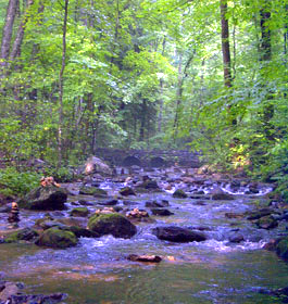
 Campground Amenities: Andrews Cove Recreation Area offers restrooms along with 10 camping sites that are equipped with tent pads, picnic tables, grills, and lantern posts. The Andrews Cove Trail follows an old logging road parallel to Andrews Creek. This trail is 2 miles long and provides access to the Appalachian Trail and Forest Service Road 283 at Indian Grave Gap. Loop through recreation area is paved. Campground Amenities: Andrews Cove Recreation Area offers restrooms along with 10 camping sites that are equipped with tent pads, picnic tables, grills, and lantern posts. The Andrews Cove Trail follows an old logging road parallel to Andrews Creek. This trail is 2 miles long and provides access to the Appalachian Trail and Forest Service Road 283 at Indian Grave Gap. Loop through recreation area is paved.
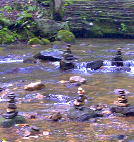
Fishing for trout in Andrews Creek is also popular among visitors. Check State fishing regulations before fishing. Andrews Cove offers convenient vehicle access from Hwy 75, a cool mountain stream and a peaceful atmosphere. Drinking water is not available at this time. Camping fee is required.
Reservations are not required. Occupancy of sites are on a first come, first serve basis.
Camping Fee: $12 per site per night |
|
 Permit Info: Georgia fishing license and trout stamp required. Please check and review Georgia's rules and regulations on fishing at www.gofishgeorgia.com Permit Info: Georgia fishing license and trout stamp required. Please check and review Georgia's rules and regulations on fishing at www.gofishgeorgia.com
Open Season: Mid-March through early November
Restrictions: The maximum length of stay is 21 days.
Closest Towns: The nearest town is approximately 5 miles, or 15 minutes, to Helen, GA. Here campers will find restaurants, grocery stores, shopping opportunities, etc.
Water: Drinking water is provided from one, centralized hand pump.
Restroom: 1 Chemical Flush facility
Passes: The Interagency Senior and Access Passes and the Golden Age and Access Passports are accepted. These passes entitle the pass holder to a 50% discount on camping fees.
Operated By: Chattahoochee Management, INC. under permit by the US Forest Service
Latitude: 34.778228 - Longitude: -83.737510 and Elevation: 1,820' |
|
| Recreation Activities |
River and Stream Fishing
Andrews Creek offers anglers the chance to catch both rainbow and brown trout. This creek extends above Andrews Cove Recreation Area for approximately two miles, and flows into Spoilcane Creek below the Area. Check State fishing regulations before fishing.
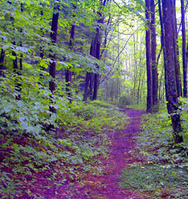
Day Hiking - The Andrews Cove Trail follows an old logging road parallel to Andrews Creek. This trail is 2 miles long and provides access to the Appalachian Trail and Forest Service Road 283 at Indian Grave Gap.
Other trails within a 30 minute drive of this campground include:
Anna Ruby Falls Trail (trail length 0.4 miles). Dukes Creek Trail (trail length 2.5 miles). Raven CliffsTrail (trail length 2.5 miles). Smith Creek Trail (trail length 4.6 miles) |
| Contact, Directions, Longitude & Latitude, and Map |
USDA Forest Service, Chattooga River Ranger District office - Phone: 706-754-6221 Address: 9975 Highway 441S, Lakemont, GA 30552
Office hours: Monday - Friday at 8-12 & 1-4:30 pm
Chattahoochee-Oconee National Forests - Phone: 770 297-3000
Address: 1755 Cleveland Highway, Gainesville, GA 30501
Office hours: Tuesday - Friday at 9 - 12 & 1-4 - Closed Saturday, Sunday, and Monday
Directions: From Helen, GA, take State Rt. 17/75 north for 5.5 miles to campground sign. Turn right into campground. - Andrews Cove Site Map |
| |
|

Georiga US Forest:
 Camping Hiking Camping Hiking
Horseback Riding Trails
FishingCanoe Trails
GA US Forest Wilderness
Wilderness Preparation
Canoe Safety Tips
Forest Safety Tips
GA U S Forest History

|